Home Brook
Map
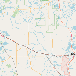
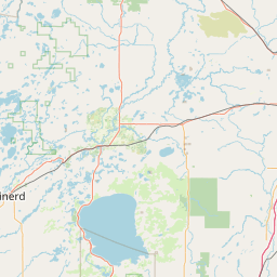
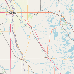
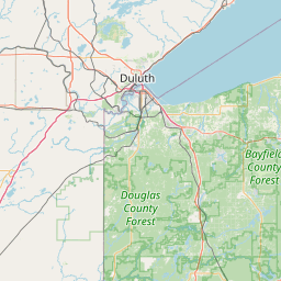
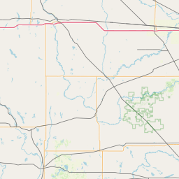
Leaflet | <a href="https://www.openstreetmap.org/copyright">© OpenStreetMap contributors</a>
Item
| Property | Value |
|---|---|
| id | 496695 |
| downstream_mainstem_id | https://geoconnex.us/ref/mainstems/430986 |
| encompassing_mainstem_basins | ['https://geoconnex.us/ref/mainstems/430986', 'https://geoconnex.us/ref/mainstems/355601', 'https://geoconnex.us/ref/mainstems/312091'] |
| featuretype | ['https://www.opengis.net/def/schema/hy_features/hyf/HY_FlowPath', 'https://www.opengis.net/def/schema/hy_features/hyf/HY_WaterBody'] |
| fid | 10475 |
| head_2020huc12 | 070101061004 |
| head_nhdpv1_comid | 4942957 |
| head_nhdpv2_comid | https://geoconnex.us/nhdplusv2/comid/4942957 |
| head_nhdpv2huc12 | https://geoconnex.us/nhdplusv2/huc12/070101061004 |
| head_rf1id | 17511 |
| lengthkm | 27.2 |
| name_at_outlet | Home Brook |
| name_at_outlet_gnis_id | 645143 |
| new_mainstemid | |
| outlet_2020huc12 | 070101061004 |
| outlet_drainagearea_sqkm | 183.2 |
| outlet_nhdpv1_comid | 4943265 |
| outlet_nhdpv2_comid | https://geoconnex.us/nhdplusv2/comid/4943265 |
| outlet_nhdpv2huc12 | https://geoconnex.us/nhdplusv2/huc12/070101061004 |
| outlet_rf1id | 17511 |
| superseded | False |
| uri | https://geoconnex.us/ref/mainstems/496695 |