Hay Creek
Map
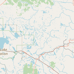
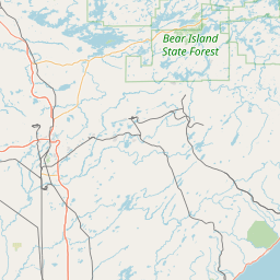
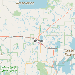
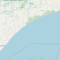
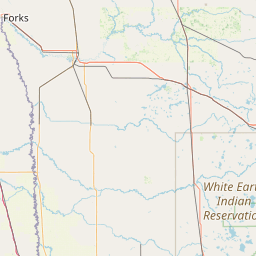
Leaflet | <a href="https://www.openstreetmap.org/copyright">© OpenStreetMap contributors</a>
Item
| Property | Value |
|---|---|
| id | 516170 |
| downstream_mainstem_id | https://geoconnex.us/ref/mainstems/375698 |
| encompassing_mainstem_basins | ['https://geoconnex.us/ref/mainstems/375698', 'https://geoconnex.us/ref/mainstems/312091'] |
| featuretype | ['https://www.opengis.net/def/schema/hy_features/hyf/HY_FlowPath', 'https://www.opengis.net/def/schema/hy_features/hyf/HY_WaterBody'] |
| fid | 10425 |
| head_2020huc12 | |
| head_nhdpv1_comid | 4836230 |
| head_nhdpv2_comid | https://geoconnex.us/nhdplusv2/comid/4836230 |
| head_nhdpv2huc12 | |
| head_rf1id | 20502 |
| lengthkm | 20.7 |
| name_at_outlet | Hay Creek |
| name_at_outlet_gnis_id | 661442 |
| new_mainstemid | |
| outlet_2020huc12 | |
| outlet_drainagearea_sqkm | 149.3 |
| outlet_nhdpv1_comid | 4836726 |
| outlet_nhdpv2_comid | https://geoconnex.us/nhdplusv2/comid/4836726 |
| outlet_nhdpv2huc12 | |
| outlet_rf1id | 20505 |
| superseded | False |
| uri | https://geoconnex.us/ref/mainstems/516170 |
Graph Results
| monitoringLocation | https://geoconnex.us/iow/wqp/MNPCA-S001-076 |
|---|---|
| siteName | MNPCA-S001-076 |
| datasetDescription | Nitrite at MNPCA-S001-076 |
| type | River/Stream |
| url | https://www.waterqualitydata.us/provider/STORET/MNPCA/MNPCA-S001-076/ |
| variableMeasured | Nitrite |
| variableUnit | milligrams per liter |
| measurementTechnique | observation |
| temporalCoverage | 1986-01-01T00:00:00Z/1986-12-31T00:00:00Z |
| distributionName | Water Quality Portal |
| distributionURL | https://www.waterqualitydata.us/data/Result/search?siteid=MNPCA-S001-076&CharacteristicName=Nitrite&mimeType=csv |
| distributionFormat | text/comma-separated-values |
| wkt | POINT (-93.095083 47.304889) |
| monitoringLocation | https://geoconnex.us/iow/wqp/MNPCA-S001-076 |
|---|---|
| siteName | MNPCA-S001-076 |
| datasetDescription | Kjeldahl nitrogen at MNPCA-S001-076 |
| type | River/Stream |
| url | https://www.waterqualitydata.us/provider/STORET/MNPCA/MNPCA-S001-076/ |
| variableMeasured | Kjeldahl nitrogen |
| variableUnit | milligrams per liter |
| measurementTechnique | observation |
| temporalCoverage | 1986-01-01T00:00:00Z/1986-12-31T00:00:00Z |
| distributionName | Water Quality Portal |
| distributionURL | https://www.waterqualitydata.us/data/Result/search?siteid=MNPCA-S001-076&CharacteristicName=Kjeldahl nitrogen&mimeType=csv |
| distributionFormat | text/comma-separated-values |
| wkt | POINT (-93.095083 47.304889) |
| monitoringLocation | https://geoconnex.us/iow/wqp/MNPCA-S001-076 |
|---|---|
| siteName | MNPCA-S001-076 |
| datasetDescription | pH at MNPCA-S001-076 |
| type | River/Stream |
| url | https://www.waterqualitydata.us/provider/STORET/MNPCA/MNPCA-S001-076/ |
| variableMeasured | pH |
| variableUnit | Unknown |
| measurementTechnique | observation |
| temporalCoverage | 1986-01-01T00:00:00Z/1986-12-31T00:00:00Z |
| distributionName | Water Quality Portal |
| distributionURL | https://www.waterqualitydata.us/data/Result/search?siteid=MNPCA-S001-076&CharacteristicName=pH&mimeType=csv |
| distributionFormat | text/comma-separated-values |
| wkt | POINT (-93.095083 47.304889) |
| monitoringLocation | https://geoconnex.us/iow/wqp/MNPCA-S001-076 |
|---|---|
| siteName | MNPCA-S001-076 |
| datasetDescription | Phosphorus at MNPCA-S001-076 |
| type | River/Stream |
| url | https://www.waterqualitydata.us/provider/STORET/MNPCA/MNPCA-S001-076/ |
| variableMeasured | Phosphorus |
| variableUnit | parts per billion |
| measurementTechnique | observation |
| temporalCoverage | 1986-01-01T00:00:00Z/1986-12-31T00:00:00Z |
| distributionName | Water Quality Portal |
| distributionURL | https://www.waterqualitydata.us/data/Result/search?siteid=MNPCA-S001-076&CharacteristicName=Phosphorus&mimeType=csv |
| distributionFormat | text/comma-separated-values |
| wkt | POINT (-93.095083 47.304889) |
| monitoringLocation | https://geoconnex.us/iow/wqp/MNPCA-S001-076 |
|---|---|
| siteName | MNPCA-S001-076 |
| datasetDescription | Ammonia-nitrogen at MNPCA-S001-076 |
| type | River/Stream |
| url | https://www.waterqualitydata.us/provider/STORET/MNPCA/MNPCA-S001-076/ |
| variableMeasured | Ammonia-nitrogen |
| variableUnit | milligrams per liter |
| measurementTechnique | observation |
| temporalCoverage | 1986-01-01T00:00:00Z/1986-12-31T00:00:00Z |
| distributionName | Water Quality Portal |
| distributionURL | https://www.waterqualitydata.us/data/Result/search?siteid=MNPCA-S001-076&CharacteristicName=Ammonia-nitrogen&mimeType=csv |
| distributionFormat | text/comma-separated-values |
| wkt | POINT (-93.095083 47.304889) |
| monitoringLocation | https://geoconnex.us/iow/wqp/MNPCA-S001-076 |
|---|---|
| siteName | MNPCA-S001-076 |
| datasetDescription | Temperature, water at MNPCA-S001-076 |
| type | River/Stream |
| url | https://www.waterqualitydata.us/provider/STORET/MNPCA/MNPCA-S001-076/ |
| variableMeasured | Temperature, water |
| variableUnit | degrees Celsius |
| measurementTechnique | observation |
| temporalCoverage | 1986-01-01T00:00:00Z/1986-12-31T00:00:00Z |
| distributionName | Water Quality Portal |
| distributionURL | https://www.waterqualitydata.us/data/Result/search?siteid=MNPCA-S001-076&CharacteristicName=Temperature, water&mimeType=csv |
| distributionFormat | text/comma-separated-values |
| wkt | POINT (-93.095083 47.304889) |
| monitoringLocation | https://geoconnex.us/iow/wqp/MNPCA-S001-076 |
|---|---|
| siteName | MNPCA-S001-076 |
| datasetDescription | Orthophosphate at MNPCA-S001-076 |
| type | River/Stream |
| url | https://www.waterqualitydata.us/provider/STORET/MNPCA/MNPCA-S001-076/ |
| variableMeasured | Orthophosphate |
| variableUnit | milligrams per liter as phosphate |
| measurementTechnique | observation |
| temporalCoverage | 1986-01-01T00:00:00Z/1986-12-31T00:00:00Z |
| distributionName | Water Quality Portal |
| distributionURL | https://www.waterqualitydata.us/data/Result/search?siteid=MNPCA-S001-076&CharacteristicName=Orthophosphate&mimeType=csv |
| distributionFormat | text/comma-separated-values |
| wkt | POINT (-93.095083 47.304889) |
| monitoringLocation | https://geoconnex.us/iow/wqp/MNPCA-S001-076 |
|---|---|
| siteName | MNPCA-S001-076 |
| datasetDescription | Organic Nitrogen at MNPCA-S001-076 |
| type | River/Stream |
| url | https://www.waterqualitydata.us/provider/STORET/MNPCA/MNPCA-S001-076/ |
| variableMeasured | Organic Nitrogen |
| variableUnit | milligrams per liter |
| measurementTechnique | observation |
| temporalCoverage | 1986-01-01T00:00:00Z/1986-12-31T00:00:00Z |
| distributionName | Water Quality Portal |
| distributionURL | https://www.waterqualitydata.us/data/Result/search?siteid=MNPCA-S001-076&CharacteristicName=Organic Nitrogen&mimeType=csv |
| distributionFormat | text/comma-separated-values |
| wkt | POINT (-93.095083 47.304889) |
| monitoringLocation | https://geoconnex.us/iow/wqp/USGS-472228093032204 |
|---|---|
| siteName | USGS-472228093032204 |
| datasetDescription | Nickel at USGS-472228093032204 |
| type | Well |
| url | https://www.waterqualitydata.us/provider/NWIS/USGS-MN/USGS-472228093032204/ |
| variableMeasured | Nickel |
| variableUnit | parts per million |
| measurementTechnique | observation |
| temporalCoverage | 1982-01-01T00:00:00Z/1982-12-31T00:00:00Z |
| distributionName | Water Quality Portal |
| distributionURL | https://www.waterqualitydata.us/data/Result/search?siteid=USGS-472228093032204&CharacteristicName=Nickel&mimeType=csv |
| distributionFormat | text/comma-separated-values |
| wkt | POINT (-93.0563048 47.37437905) |
| monitoringLocation | https://geoconnex.us/iow/wqp/USGS-472228093032204 |
|---|---|
| siteName | USGS-472228093032204 |
| datasetDescription | Beryllium at USGS-472228093032204 |
| type | Well |
| url | https://www.waterqualitydata.us/provider/NWIS/USGS-MN/USGS-472228093032204/ |
| variableMeasured | Beryllium |
| variableUnit | parts per million |
| measurementTechnique | observation |
| temporalCoverage | 1982-01-01T00:00:00Z/1982-12-31T00:00:00Z |
| distributionName | Water Quality Portal |
| distributionURL | https://www.waterqualitydata.us/data/Result/search?siteid=USGS-472228093032204&CharacteristicName=Beryllium&mimeType=csv |
| distributionFormat | text/comma-separated-values |
| wkt | POINT (-93.0563048 47.37437905) |
| monitoringLocation | https://geoconnex.us/iow/wqp/USGS-472228093032204 |
|---|---|
| siteName | USGS-472228093032204 |
| datasetDescription | Inorganic nitrogen (nitrate and nitrite) at USGS-472228093032204 |
| type | Well |
| url | https://www.waterqualitydata.us/provider/NWIS/USGS-MN/USGS-472228093032204/ |
| variableMeasured | Inorganic nitrogen (nitrate and nitrite) |
| variableUnit | milligrams per liter as nitrogen |
| measurementTechnique | observation |
| temporalCoverage | 1982-01-01T00:00:00Z/1984-12-31T00:00:00Z |
| distributionName | Water Quality Portal |
| distributionURL | https://www.waterqualitydata.us/data/Result/search?siteid=USGS-472228093032204&CharacteristicName=Inorganic nitrogen (nitrate and nitrite)&mimeType=csv |
| distributionFormat | text/comma-separated-values |
| wkt | POINT (-93.0563048 47.37437905) |
| monitoringLocation | https://geoconnex.us/iow/wqp/USGS-472228093032204 |
|---|---|
| siteName | USGS-472228093032204 |
| datasetDescription | Silica at USGS-472228093032204 |
| type | Well |
| url | https://www.waterqualitydata.us/provider/NWIS/USGS-MN/USGS-472228093032204/ |
| variableMeasured | Silica |
| variableUnit | milligrams per liter |
| measurementTechnique | observation |
| temporalCoverage | 1982-01-01T00:00:00Z/1984-12-31T00:00:00Z |
| distributionName | Water Quality Portal |
| distributionURL | https://www.waterqualitydata.us/data/Result/search?siteid=USGS-472228093032204&CharacteristicName=Silica&mimeType=csv |
| distributionFormat | text/comma-separated-values |
| wkt | POINT (-93.0563048 47.37437905) |
| monitoringLocation | https://geoconnex.us/iow/wqp/USGS-472228093032204 |
|---|---|
| siteName | USGS-472228093032204 |
| datasetDescription | Organic carbon at USGS-472228093032204 |
| type | Well |
| url | https://www.waterqualitydata.us/provider/NWIS/USGS-MN/USGS-472228093032204/ |
| variableMeasured | Organic carbon |
| variableUnit | milligrams per liter |
| measurementTechnique | observation |
| temporalCoverage | 1982-01-01T00:00:00Z/1984-12-31T00:00:00Z |
| distributionName | Water Quality Portal |
| distributionURL | https://www.waterqualitydata.us/data/Result/search?siteid=USGS-472228093032204&CharacteristicName=Organic carbon&mimeType=csv |
| distributionFormat | text/comma-separated-values |
| wkt | POINT (-93.0563048 47.37437905) |
| monitoringLocation | https://geoconnex.us/iow/wqp/USGS-472228093032204 |
|---|---|
| siteName | USGS-472228093032204 |
| datasetDescription | Phosphate-phosphorus at USGS-472228093032204 |
| type | Well |
| url | https://www.waterqualitydata.us/provider/NWIS/USGS-MN/USGS-472228093032204/ |
| variableMeasured | Phosphate-phosphorus |
| variableUnit | milligrams per liter |
| measurementTechnique | observation |
| temporalCoverage | 1982-01-01T00:00:00Z/1984-12-31T00:00:00Z |
| distributionName | Water Quality Portal |
| distributionURL | https://www.waterqualitydata.us/data/Result/search?siteid=USGS-472228093032204&CharacteristicName=Phosphate-phosphorus&mimeType=csv |
| distributionFormat | text/comma-separated-values |
| wkt | POINT (-93.0563048 47.37437905) |
| monitoringLocation | https://geoconnex.us/iow/wqp/USGS-472228093032204 |
|---|---|
| siteName | USGS-472228093032204 |
| datasetDescription | Chromium at USGS-472228093032204 |
| type | Well |
| url | https://www.waterqualitydata.us/provider/NWIS/USGS-MN/USGS-472228093032204/ |
| variableMeasured | Chromium |
| variableUnit | parts per billion |
| measurementTechnique | observation |
| temporalCoverage | 1982-01-01T00:00:00Z/1982-12-31T00:00:00Z |
| distributionName | Water Quality Portal |
| distributionURL | https://www.waterqualitydata.us/data/Result/search?siteid=USGS-472228093032204&CharacteristicName=Chromium&mimeType=csv |
| distributionFormat | text/comma-separated-values |
| wkt | POINT (-93.0563048 47.37437905) |
| monitoringLocation | https://geoconnex.us/iow/wqp/USGS-472228093032204 |
|---|---|
| siteName | USGS-472228093032204 |
| datasetDescription | Molybdenum at USGS-472228093032204 |
| type | Well |
| url | https://www.waterqualitydata.us/provider/NWIS/USGS-MN/USGS-472228093032204/ |
| variableMeasured | Molybdenum |
| variableUnit | parts per billion |
| measurementTechnique | observation |
| temporalCoverage | 1982-01-01T00:00:00Z/1982-12-31T00:00:00Z |
| distributionName | Water Quality Portal |
| distributionURL | https://www.waterqualitydata.us/data/Result/search?siteid=USGS-472228093032204&CharacteristicName=Molybdenum&mimeType=csv |
| distributionFormat | text/comma-separated-values |
| wkt | POINT (-93.0563048 47.37437905) |
| monitoringLocation | https://geoconnex.us/iow/wqp/USGS-472228093032204 |
|---|---|
| siteName | USGS-472228093032204 |
| datasetDescription | Mercury at USGS-472228093032204 |
| type | Well |
| url | https://www.waterqualitydata.us/provider/NWIS/USGS-MN/USGS-472228093032204/ |
| variableMeasured | Mercury |
| variableUnit | Unknown |
| measurementTechnique | observation |
| temporalCoverage | 1982-01-01T00:00:00Z/1982-12-31T00:00:00Z |
| distributionName | Water Quality Portal |
| distributionURL | https://www.waterqualitydata.us/data/Result/search?siteid=USGS-472228093032204&CharacteristicName=Mercury&mimeType=csv |
| distributionFormat | text/comma-separated-values |
| wkt | POINT (-93.0563048 47.37437905) |
| monitoringLocation | https://geoconnex.us/iow/wqp/USGS-472228093032204 |
|---|---|
| siteName | USGS-472228093032204 |
| datasetDescription | Temperature, air at USGS-472228093032204 |
| type | Well |
| url | https://www.waterqualitydata.us/provider/NWIS/USGS-MN/USGS-472228093032204/ |
| variableMeasured | Temperature, air |
| variableUnit | degrees Celsius |
| measurementTechnique | observation |
| temporalCoverage | 1983-01-01T00:00:00Z/1984-12-31T00:00:00Z |
| distributionName | Water Quality Portal |
| distributionURL | https://www.waterqualitydata.us/data/Result/search?siteid=USGS-472228093032204&CharacteristicName=Temperature, air&mimeType=csv |
| distributionFormat | text/comma-separated-values |
| wkt | POINT (-93.0563048 47.37437905) |
| monitoringLocation | https://geoconnex.us/iow/wqp/USGS-472228093032204 |
|---|---|
| siteName | USGS-472228093032204 |
| datasetDescription | Volatile dissolved solids at USGS-472228093032204 |
| type | Well |
| url | https://www.waterqualitydata.us/provider/NWIS/USGS-MN/USGS-472228093032204/ |
| variableMeasured | Volatile dissolved solids |
| variableUnit | milligrams per liter |
| measurementTechnique | observation |
| temporalCoverage | 1982-01-01T00:00:00Z/1982-12-31T00:00:00Z |
| distributionName | Water Quality Portal |
| distributionURL | https://www.waterqualitydata.us/data/Result/search?siteid=USGS-472228093032204&CharacteristicName=Volatile dissolved solids&mimeType=csv |
| distributionFormat | text/comma-separated-values |
| wkt | POINT (-93.0563048 47.37437905) |
| monitoringLocation | https://geoconnex.us/iow/wqp/USGS-472228093032204 |
|---|---|
| siteName | USGS-472228093032204 |
| datasetDescription | Specific conductance at USGS-472228093032204 |
| type | Well |
| url | https://www.waterqualitydata.us/provider/NWIS/USGS-MN/USGS-472228093032204/ |
| variableMeasured | Specific conductance |
| variableUnit | microsiemens per centimeter |
| measurementTechnique | observation |
| temporalCoverage | 1982-01-01T00:00:00Z/1984-12-31T00:00:00Z |
| distributionName | Water Quality Portal |
| distributionURL | https://www.waterqualitydata.us/data/Result/search?siteid=USGS-472228093032204&CharacteristicName=Specific conductance&mimeType=csv |
| distributionFormat | text/comma-separated-values |
| wkt | POINT (-93.0563048 47.37437905) |
| monitoringLocation | https://geoconnex.us/iow/wqp/USGS-472228093032204 |
|---|---|
| siteName | USGS-472228093032204 |
| datasetDescription | Alkalinity at USGS-472228093032204 |
| type | Well |
| url | https://www.waterqualitydata.us/provider/NWIS/USGS-MN/USGS-472228093032204/ |
| variableMeasured | Alkalinity |
| variableUnit | milligrams per liter as calcium carbonate |
| measurementTechnique | observation |
| temporalCoverage | 1982-01-01T00:00:00Z/1984-12-31T00:00:00Z |
| distributionName | Water Quality Portal |
| distributionURL | https://www.waterqualitydata.us/data/Result/search?siteid=USGS-472228093032204&CharacteristicName=Alkalinity&mimeType=csv |
| distributionFormat | text/comma-separated-values |
| wkt | POINT (-93.0563048 47.37437905) |
| monitoringLocation | https://geoconnex.us/iow/wqp/USGS-472228093032204 |
|---|---|
| siteName | USGS-472228093032204 |
| datasetDescription | Kjeldahl nitrogen at USGS-472228093032204 |
| type | Well |
| url | https://www.waterqualitydata.us/provider/NWIS/USGS-MN/USGS-472228093032204/ |
| variableMeasured | Kjeldahl nitrogen |
| variableUnit | milligrams per liter |
| measurementTechnique | observation |
| temporalCoverage | 1982-01-01T00:00:00Z/1984-12-31T00:00:00Z |
| distributionName | Water Quality Portal |
| distributionURL | https://www.waterqualitydata.us/data/Result/search?siteid=USGS-472228093032204&CharacteristicName=Kjeldahl nitrogen&mimeType=csv |
| distributionFormat | text/comma-separated-values |
| wkt | POINT (-93.0563048 47.37437905) |
| monitoringLocation | https://geoconnex.us/iow/wqp/USGS-472228093032204 |
|---|---|
| siteName | USGS-472228093032204 |
| datasetDescription | Hardness, Ca, Mg at USGS-472228093032204 |
| type | Well |
| url | https://www.waterqualitydata.us/provider/NWIS/USGS-MN/USGS-472228093032204/ |
| variableMeasured | Hardness, Ca, Mg |
| variableUnit | milligrams per liter as calcium carbonate |
| measurementTechnique | observation |
| temporalCoverage | 1982-01-01T00:00:00Z/1984-12-31T00:00:00Z |
| distributionName | Water Quality Portal |
| distributionURL | https://www.waterqualitydata.us/data/Result/search?siteid=USGS-472228093032204&CharacteristicName=Hardness, Ca, Mg&mimeType=csv |
| distributionFormat | text/comma-separated-values |
| wkt | POINT (-93.0563048 47.37437905) |
| monitoringLocation | https://geoconnex.us/iow/wqp/USGS-472228093032204 |
|---|---|
| siteName | USGS-472228093032204 |
| datasetDescription | Sodium, percent total cations at USGS-472228093032204 |
| type | Well |
| url | https://www.waterqualitydata.us/provider/NWIS/USGS-MN/USGS-472228093032204/ |
| variableMeasured | Sodium, percent total cations |
| variableUnit | percent |
| measurementTechnique | observation |
| temporalCoverage | 1982-01-01T00:00:00Z/1984-12-31T00:00:00Z |
| distributionName | Water Quality Portal |
| distributionURL | https://www.waterqualitydata.us/data/Result/search?siteid=USGS-472228093032204&CharacteristicName=Sodium, percent total cations&mimeType=csv |
| distributionFormat | text/comma-separated-values |
| wkt | POINT (-93.0563048 47.37437905) |
| monitoringLocation | https://geoconnex.us/iow/wqp/USGS-472228093032204 |
|---|---|
| siteName | USGS-472228093032204 |
| datasetDescription | Depth at USGS-472228093032204 |
| type | Well |
| url | https://www.waterqualitydata.us/provider/NWIS/USGS-MN/USGS-472228093032204/ |
| variableMeasured | Depth |
| variableUnit | feet |
| measurementTechnique | observation |
| temporalCoverage | 1983-01-01T00:00:00Z/1984-12-31T00:00:00Z |
| distributionName | Water Quality Portal |
| distributionURL | https://www.waterqualitydata.us/data/Result/search?siteid=USGS-472228093032204&CharacteristicName=Depth&mimeType=csv |
| distributionFormat | text/comma-separated-values |
| wkt | POINT (-93.0563048 47.37437905) |
| monitoringLocation | https://geoconnex.us/iow/wqp/USGS-472228093032204 |
|---|---|
| siteName | USGS-472228093032204 |
| datasetDescription | Cobalt at USGS-472228093032204 |
| type | Well |
| url | https://www.waterqualitydata.us/provider/NWIS/USGS-MN/USGS-472228093032204/ |
| variableMeasured | Cobalt |
| variableUnit | milligrams per liter |
| measurementTechnique | observation |
| temporalCoverage | 1982-01-01T00:00:00Z/1982-12-31T00:00:00Z |
| distributionName | Water Quality Portal |
| distributionURL | https://www.waterqualitydata.us/data/Result/search?siteid=USGS-472228093032204&CharacteristicName=Cobalt&mimeType=csv |
| distributionFormat | text/comma-separated-values |
| wkt | POINT (-93.0563048 47.37437905) |
| monitoringLocation | https://geoconnex.us/iow/wqp/USGS-472228093032204 |
|---|---|
| siteName | USGS-472228093032204 |
| datasetDescription | Zinc at USGS-472228093032204 |
| type | Well |
| url | https://www.waterqualitydata.us/provider/NWIS/USGS-MN/USGS-472228093032204/ |
| variableMeasured | Zinc |
| variableUnit | Unknown |
| measurementTechnique | observation |
| temporalCoverage | 1982-01-01T00:00:00Z/1982-12-31T00:00:00Z |
| distributionName | Water Quality Portal |
| distributionURL | https://www.waterqualitydata.us/data/Result/search?siteid=USGS-472228093032204&CharacteristicName=Zinc&mimeType=csv |
| distributionFormat | text/comma-separated-values |
| wkt | POINT (-93.0563048 47.37437905) |
| monitoringLocation | https://geoconnex.us/iow/wqp/USGS-472228093032204 |
|---|---|
| siteName | USGS-472228093032204 |
| datasetDescription | Phenols at USGS-472228093032204 |
| type | Well |
| url | https://www.waterqualitydata.us/provider/NWIS/USGS-MN/USGS-472228093032204/ |
| variableMeasured | Phenols |
| variableUnit | micrograms per liter |
| measurementTechnique | observation |
| temporalCoverage | 1982-01-01T00:00:00Z/1982-12-31T00:00:00Z |
| distributionName | Water Quality Portal |
| distributionURL | https://www.waterqualitydata.us/data/Result/search?siteid=USGS-472228093032204&CharacteristicName=Phenols&mimeType=csv |
| distributionFormat | text/comma-separated-values |
| wkt | POINT (-93.0563048 47.37437905) |
| monitoringLocation | https://geoconnex.us/iow/wqp/USGS-472228093032204 |
|---|---|
| siteName | USGS-472228093032204 |
| datasetDescription | Chemical oxygen demand, (high level) at USGS-472228093032204 |
| type | Well |
| url | https://www.waterqualitydata.us/provider/NWIS/USGS-MN/USGS-472228093032204/ |
| variableMeasured | Chemical oxygen demand, (high level) |
| variableUnit | milligrams per liter |
| measurementTechnique | observation |
| temporalCoverage | 1982-01-01T00:00:00Z/1982-12-31T00:00:00Z |
| distributionName | Water Quality Portal |
| distributionURL | https://www.waterqualitydata.us/data/Result/search?siteid=USGS-472228093032204&CharacteristicName=Chemical oxygen demand, (high level)&mimeType=csv |
| distributionFormat | text/comma-separated-values |
| wkt | POINT (-93.0563048 47.37437905) |
| monitoringLocation | https://geoconnex.us/iow/wqp/USGS-472228093032204 |
|---|---|
| siteName | USGS-472228093032204 |
| datasetDescription | Chloride at USGS-472228093032204 |
| type | Well |
| url | https://www.waterqualitydata.us/provider/NWIS/USGS-MN/USGS-472228093032204/ |
| variableMeasured | Chloride |
| variableUnit | milligrams per liter |
| measurementTechnique | observation |
| temporalCoverage | 1982-01-01T00:00:00Z/1984-12-31T00:00:00Z |
| distributionName | Water Quality Portal |
| distributionURL | https://www.waterqualitydata.us/data/Result/search?siteid=USGS-472228093032204&CharacteristicName=Chloride&mimeType=csv |
| distributionFormat | text/comma-separated-values |
| wkt | POINT (-93.0563048 47.37437905) |
| monitoringLocation | https://geoconnex.us/iow/wqp/USGS-472228093032204 |
|---|---|
| siteName | USGS-472228093032204 |
| datasetDescription | Sodium at USGS-472228093032204 |
| type | Well |
| url | https://www.waterqualitydata.us/provider/NWIS/USGS-MN/USGS-472228093032204/ |
| variableMeasured | Sodium |
| variableUnit | milligrams per liter |
| measurementTechnique | observation |
| temporalCoverage | 1982-01-01T00:00:00Z/1984-12-31T00:00:00Z |
| distributionName | Water Quality Portal |
| distributionURL | https://www.waterqualitydata.us/data/Result/search?siteid=USGS-472228093032204&CharacteristicName=Sodium&mimeType=csv |
| distributionFormat | text/comma-separated-values |
| wkt | POINT (-93.0563048 47.37437905) |
| monitoringLocation | https://geoconnex.us/iow/wqp/USGS-472228093032204 |
|---|---|
| siteName | USGS-472228093032204 |
| datasetDescription | Selenium at USGS-472228093032204 |
| type | Well |
| url | https://www.waterqualitydata.us/provider/NWIS/USGS-MN/USGS-472228093032204/ |
| variableMeasured | Selenium |
| variableUnit | micrograms per liter |
| measurementTechnique | observation |
| temporalCoverage | 1982-01-01T00:00:00Z/1982-12-31T00:00:00Z |
| distributionName | Water Quality Portal |
| distributionURL | https://www.waterqualitydata.us/data/Result/search?siteid=USGS-472228093032204&CharacteristicName=Selenium&mimeType=csv |
| distributionFormat | text/comma-separated-values |
| wkt | POINT (-93.0563048 47.37437905) |
| monitoringLocation | https://geoconnex.us/iow/wqp/USGS-472228093032204 |
|---|---|
| siteName | USGS-472228093032204 |
| datasetDescription | Ammonia and ammonium at USGS-472228093032204 |
| type | Well |
| url | https://www.waterqualitydata.us/provider/NWIS/USGS-MN/USGS-472228093032204/ |
| variableMeasured | Ammonia and ammonium |
| variableUnit | Unknown |
| measurementTechnique | observation |
| temporalCoverage | 1982-01-01T00:00:00Z/1984-12-31T00:00:00Z |
| distributionName | Water Quality Portal |
| distributionURL | https://www.waterqualitydata.us/data/Result/search?siteid=USGS-472228093032204&CharacteristicName=Ammonia and ammonium&mimeType=csv |
| distributionFormat | text/comma-separated-values |
| wkt | POINT (-93.0563048 47.37437905) |
| monitoringLocation | https://geoconnex.us/iow/wqp/USGS-472228093032204 |
|---|---|
| siteName | USGS-472228093032204 |
| datasetDescription | Cadmium at USGS-472228093032204 |
| type | Well |
| url | https://www.waterqualitydata.us/provider/NWIS/USGS-MN/USGS-472228093032204/ |
| variableMeasured | Cadmium |
| variableUnit | micrograms per liter |
| measurementTechnique | observation |
| temporalCoverage | 1982-01-01T00:00:00Z/1982-12-31T00:00:00Z |
| distributionName | Water Quality Portal |
| distributionURL | https://www.waterqualitydata.us/data/Result/search?siteid=USGS-472228093032204&CharacteristicName=Cadmium&mimeType=csv |
| distributionFormat | text/comma-separated-values |
| wkt | POINT (-93.0563048 47.37437905) |
| monitoringLocation | https://geoconnex.us/iow/wqp/USGS-472228093032204 |
|---|---|
| siteName | USGS-472228093032204 |
| datasetDescription | Manganese at USGS-472228093032204 |
| type | Well |
| url | https://www.waterqualitydata.us/provider/NWIS/USGS-MN/USGS-472228093032204/ |
| variableMeasured | Manganese |
| variableUnit | micrograms per liter |
| measurementTechnique | observation |
| temporalCoverage | 1982-01-01T00:00:00Z/1984-12-31T00:00:00Z |
| distributionName | Water Quality Portal |
| distributionURL | https://www.waterqualitydata.us/data/Result/search?siteid=USGS-472228093032204&CharacteristicName=Manganese&mimeType=csv |
| distributionFormat | text/comma-separated-values |
| wkt | POINT (-93.0563048 47.37437905) |
| monitoringLocation | https://geoconnex.us/iow/wqp/USGS-472228093032204 |
|---|---|
| siteName | USGS-472228093032204 |
| datasetDescription | Oxygen at USGS-472228093032204 |
| type | Well |
| url | https://www.waterqualitydata.us/provider/NWIS/USGS-MN/USGS-472228093032204/ |
| variableMeasured | Oxygen |
| variableUnit | milligrams per liter |
| measurementTechnique | observation |
| temporalCoverage | 1983-01-01T00:00:00Z/1983-12-31T00:00:00Z |
| distributionName | Water Quality Portal |
| distributionURL | https://www.waterqualitydata.us/data/Result/search?siteid=USGS-472228093032204&CharacteristicName=Oxygen&mimeType=csv |
| distributionFormat | text/comma-separated-values |
| wkt | POINT (-93.0563048 47.37437905) |
| monitoringLocation | https://geoconnex.us/iow/wqp/USGS-472228093032204 |
|---|---|
| siteName | USGS-472228093032204 |
| datasetDescription | Copper at USGS-472228093032204 |
| type | Well |
| url | https://www.waterqualitydata.us/provider/NWIS/USGS-MN/USGS-472228093032204/ |
| variableMeasured | Copper |
| variableUnit | Unknown |
| measurementTechnique | observation |
| temporalCoverage | 1982-01-01T00:00:00Z/1982-12-31T00:00:00Z |
| distributionName | Water Quality Portal |
| distributionURL | https://www.waterqualitydata.us/data/Result/search?siteid=USGS-472228093032204&CharacteristicName=Copper&mimeType=csv |
| distributionFormat | text/comma-separated-values |
| wkt | POINT (-93.0563048 47.37437905) |
| monitoringLocation | https://geoconnex.us/iow/wqp/USGS-472228093032204 |
|---|---|
| siteName | USGS-472228093032204 |
| datasetDescription | Boron at USGS-472228093032204 |
| type | Well |
| url | https://www.waterqualitydata.us/provider/NWIS/USGS-MN/USGS-472228093032204/ |
| variableMeasured | Boron |
| variableUnit | Unknown |
| measurementTechnique | observation |
| temporalCoverage | 1982-01-01T00:00:00Z/1982-12-31T00:00:00Z |
| distributionName | Water Quality Portal |
| distributionURL | https://www.waterqualitydata.us/data/Result/search?siteid=USGS-472228093032204&CharacteristicName=Boron&mimeType=csv |
| distributionFormat | text/comma-separated-values |
| wkt | POINT (-93.0563048 47.37437905) |
| monitoringLocation | https://geoconnex.us/iow/wqp/USGS-472228093032204 |
|---|---|
| siteName | USGS-472228093032204 |
| datasetDescription | Lithium at USGS-472228093032204 |
| type | Well |
| url | https://www.waterqualitydata.us/provider/NWIS/USGS-MN/USGS-472228093032204/ |
| variableMeasured | Lithium |
| variableUnit | micrograms per liter |
| measurementTechnique | observation |
| temporalCoverage | 1982-01-01T00:00:00Z/1982-12-31T00:00:00Z |
| distributionName | Water Quality Portal |
| distributionURL | https://www.waterqualitydata.us/data/Result/search?siteid=USGS-472228093032204&CharacteristicName=Lithium&mimeType=csv |
| distributionFormat | text/comma-separated-values |
| wkt | POINT (-93.0563048 47.37437905) |
| monitoringLocation | https://geoconnex.us/iow/wqp/USGS-472228093032204 |
|---|---|
| siteName | USGS-472228093032204 |
| datasetDescription | Barium at USGS-472228093032204 |
| type | Well |
| url | https://www.waterqualitydata.us/provider/NWIS/USGS-MN/USGS-472228093032204/ |
| variableMeasured | Barium |
| variableUnit | micrograms per liter |
| measurementTechnique | observation |
| temporalCoverage | 1982-01-01T00:00:00Z/1982-12-31T00:00:00Z |
| distributionName | Water Quality Portal |
| distributionURL | https://www.waterqualitydata.us/data/Result/search?siteid=USGS-472228093032204&CharacteristicName=Barium&mimeType=csv |
| distributionFormat | text/comma-separated-values |
| wkt | POINT (-93.0563048 47.37437905) |
| monitoringLocation | https://geoconnex.us/iow/wqp/USGS-472228093032204 |
|---|---|
| siteName | USGS-472228093032204 |
| datasetDescription | Carbon dioxide at USGS-472228093032204 |
| type | Well |
| url | https://www.waterqualitydata.us/provider/NWIS/USGS-MN/USGS-472228093032204/ |
| variableMeasured | Carbon dioxide |
| variableUnit | milligrams per liter |
| measurementTechnique | observation |
| temporalCoverage | 1982-01-01T00:00:00Z/1984-12-31T00:00:00Z |
| distributionName | Water Quality Portal |
| distributionURL | https://www.waterqualitydata.us/data/Result/search?siteid=USGS-472228093032204&CharacteristicName=Carbon dioxide&mimeType=csv |
| distributionFormat | text/comma-separated-values |
| wkt | POINT (-93.0563048 47.37437905) |
| monitoringLocation | https://geoconnex.us/iow/wqp/USGS-472228093032204 |
|---|---|
| siteName | USGS-472228093032204 |
| datasetDescription | Total dissolved solids at USGS-472228093032204 |
| type | Well |
| url | https://www.waterqualitydata.us/provider/NWIS/USGS-MN/USGS-472228093032204/ |
| variableMeasured | Total dissolved solids |
| variableUnit | milligrams per liter |
| measurementTechnique | observation |
| temporalCoverage | 1982-01-01T00:00:00Z/1984-12-31T00:00:00Z |
| distributionName | Water Quality Portal |
| distributionURL | https://www.waterqualitydata.us/data/Result/search?siteid=USGS-472228093032204&CharacteristicName=Total dissolved solids&mimeType=csv |
| distributionFormat | text/comma-separated-values |
| wkt | POINT (-93.0563048 47.37437905) |
| monitoringLocation | https://geoconnex.us/iow/wqp/USGS-472228093032204 |
|---|---|
| siteName | USGS-472228093032204 |
| datasetDescription | pH at USGS-472228093032204 |
| type | Well |
| url | https://www.waterqualitydata.us/provider/NWIS/USGS-MN/USGS-472228093032204/ |
| variableMeasured | pH |
| variableUnit | Unknown |
| measurementTechnique | observation |
| temporalCoverage | 1982-01-01T00:00:00Z/1984-12-31T00:00:00Z |
| distributionName | Water Quality Portal |
| distributionURL | https://www.waterqualitydata.us/data/Result/search?siteid=USGS-472228093032204&CharacteristicName=pH&mimeType=csv |
| distributionFormat | text/comma-separated-values |
| wkt | POINT (-93.0563048 47.37437905) |
| monitoringLocation | https://geoconnex.us/iow/wqp/USGS-472228093032204 |
|---|---|
| siteName | USGS-472228093032204 |
| datasetDescription | Sulfate at USGS-472228093032204 |
| type | Well |
| url | https://www.waterqualitydata.us/provider/NWIS/USGS-MN/USGS-472228093032204/ |
| variableMeasured | Sulfate |
| variableUnit | milligrams per liter |
| measurementTechnique | observation |
| temporalCoverage | 1982-01-01T00:00:00Z/1984-12-31T00:00:00Z |
| distributionName | Water Quality Portal |
| distributionURL | https://www.waterqualitydata.us/data/Result/search?siteid=USGS-472228093032204&CharacteristicName=Sulfate&mimeType=csv |
| distributionFormat | text/comma-separated-values |
| wkt | POINT (-93.0563048 47.37437905) |
| monitoringLocation | https://geoconnex.us/iow/wqp/USGS-472228093032204 |
|---|---|
| siteName | USGS-472228093032204 |
| datasetDescription | Orthophosphate at USGS-472228093032204 |
| type | Well |
| url | https://www.waterqualitydata.us/provider/NWIS/USGS-MN/USGS-472228093032204/ |
| variableMeasured | Orthophosphate |
| variableUnit | milligrams per liter as phosphate |
| measurementTechnique | observation |
| temporalCoverage | 1982-01-01T00:00:00Z/1984-12-31T00:00:00Z |
| distributionName | Water Quality Portal |
| distributionURL | https://www.waterqualitydata.us/data/Result/search?siteid=USGS-472228093032204&CharacteristicName=Orthophosphate&mimeType=csv |
| distributionFormat | text/comma-separated-values |
| wkt | POINT (-93.0563048 47.37437905) |
| monitoringLocation | https://geoconnex.us/iow/wqp/USGS-472228093032204 |
|---|---|
| siteName | USGS-472228093032204 |
| datasetDescription | Fluoride at USGS-472228093032204 |
| type | Well |
| url | https://www.waterqualitydata.us/provider/NWIS/USGS-MN/USGS-472228093032204/ |
| variableMeasured | Fluoride |
| variableUnit | milligrams per liter |
| measurementTechnique | observation |
| temporalCoverage | 1982-01-01T00:00:00Z/1984-12-31T00:00:00Z |
| distributionName | Water Quality Portal |
| distributionURL | https://www.waterqualitydata.us/data/Result/search?siteid=USGS-472228093032204&CharacteristicName=Fluoride&mimeType=csv |
| distributionFormat | text/comma-separated-values |
| wkt | POINT (-93.0563048 47.37437905) |
| monitoringLocation | https://geoconnex.us/iow/wqp/USGS-472228093032204 |
|---|---|
| siteName | USGS-472228093032204 |
| datasetDescription | Iron at USGS-472228093032204 |
| type | Well |
| url | https://www.waterqualitydata.us/provider/NWIS/USGS-MN/USGS-472228093032204/ |
| variableMeasured | Iron |
| variableUnit | percent |
| measurementTechnique | observation |
| temporalCoverage | 1982-01-01T00:00:00Z/1982-12-31T00:00:00Z |
| distributionName | Water Quality Portal |
| distributionURL | https://www.waterqualitydata.us/data/Result/search?siteid=USGS-472228093032204&CharacteristicName=Iron&mimeType=csv |
| distributionFormat | text/comma-separated-values |
| wkt | POINT (-93.0563048 47.37437905) |
| monitoringLocation | https://geoconnex.us/iow/wqp/USGS-472228093032204 |
|---|---|
| siteName | USGS-472228093032204 |
| datasetDescription | Potassium at USGS-472228093032204 |
| type | Well |
| url | https://www.waterqualitydata.us/provider/NWIS/USGS-MN/USGS-472228093032204/ |
| variableMeasured | Potassium |
| variableUnit | milligrams per liter |
| measurementTechnique | observation |
| temporalCoverage | 1982-01-01T00:00:00Z/1984-12-31T00:00:00Z |
| distributionName | Water Quality Portal |
| distributionURL | https://www.waterqualitydata.us/data/Result/search?siteid=USGS-472228093032204&CharacteristicName=Potassium&mimeType=csv |
| distributionFormat | text/comma-separated-values |
| wkt | POINT (-93.0563048 47.37437905) |
| monitoringLocation | https://geoconnex.us/iow/wqp/USGS-472228093032204 |
|---|---|
| siteName | USGS-472228093032204 |
| datasetDescription | Lead at USGS-472228093032204 |
| type | Well |
| url | https://www.waterqualitydata.us/provider/NWIS/USGS-MN/USGS-472228093032204/ |
| variableMeasured | Lead |
| variableUnit | micrograms per liter |
| measurementTechnique | observation |
| temporalCoverage | 1982-01-01T00:00:00Z/1982-12-31T00:00:00Z |
| distributionName | Water Quality Portal |
| distributionURL | https://www.waterqualitydata.us/data/Result/search?siteid=USGS-472228093032204&CharacteristicName=Lead&mimeType=csv |
| distributionFormat | text/comma-separated-values |
| wkt | POINT (-93.0563048 47.37437905) |
| monitoringLocation | https://geoconnex.us/iow/wqp/USGS-472228093032204 |
|---|---|
| siteName | USGS-472228093032204 |
| datasetDescription | Arsenic at USGS-472228093032204 |
| type | Well |
| url | https://www.waterqualitydata.us/provider/NWIS/USGS-MN/USGS-472228093032204/ |
| variableMeasured | Arsenic |
| variableUnit | parts per million |
| measurementTechnique | observation |
| temporalCoverage | 1982-01-01T00:00:00Z/1982-12-31T00:00:00Z |
| distributionName | Water Quality Portal |
| distributionURL | https://www.waterqualitydata.us/data/Result/search?siteid=USGS-472228093032204&CharacteristicName=Arsenic&mimeType=csv |
| distributionFormat | text/comma-separated-values |
| wkt | POINT (-93.0563048 47.37437905) |
| monitoringLocation | https://geoconnex.us/iow/wqp/USGS-472228093032204 |
|---|---|
| siteName | USGS-472228093032204 |
| datasetDescription | Temperature, water at USGS-472228093032204 |
| type | Well |
| url | https://www.waterqualitydata.us/provider/NWIS/USGS-MN/USGS-472228093032204/ |
| variableMeasured | Temperature, water |
| variableUnit | degrees Celsius |
| measurementTechnique | observation |
| temporalCoverage | 1982-01-01T00:00:00Z/1984-12-31T00:00:00Z |
| distributionName | Water Quality Portal |
| distributionURL | https://www.waterqualitydata.us/data/Result/search?siteid=USGS-472228093032204&CharacteristicName=Temperature, water&mimeType=csv |
| distributionFormat | text/comma-separated-values |
| wkt | POINT (-93.0563048 47.37437905) |
| monitoringLocation | https://geoconnex.us/iow/wqp/USGS-472228093032204 |
|---|---|
| siteName | USGS-472228093032204 |
| datasetDescription | Vanadium at USGS-472228093032204 |
| type | Well |
| url | https://www.waterqualitydata.us/provider/NWIS/USGS-MN/USGS-472228093032204/ |
| variableMeasured | Vanadium |
| variableUnit | milligrams per kilogram |
| measurementTechnique | observation |
| temporalCoverage | 1982-01-01T00:00:00Z/1982-12-31T00:00:00Z |
| distributionName | Water Quality Portal |
| distributionURL | https://www.waterqualitydata.us/data/Result/search?siteid=USGS-472228093032204&CharacteristicName=Vanadium&mimeType=csv |
| distributionFormat | text/comma-separated-values |
| wkt | POINT (-93.0563048 47.37437905) |
| monitoringLocation | https://geoconnex.us/iow/wqp/USGS-472228093032204 |
|---|---|
| siteName | USGS-472228093032204 |
| datasetDescription | Organic Nitrogen at USGS-472228093032204 |
| type | Well |
| url | https://www.waterqualitydata.us/provider/NWIS/USGS-MN/USGS-472228093032204/ |
| variableMeasured | Organic Nitrogen |
| variableUnit | milligrams per liter |
| measurementTechnique | observation |
| temporalCoverage | 1982-01-01T00:00:00Z/1984-12-31T00:00:00Z |
| distributionName | Water Quality Portal |
| distributionURL | https://www.waterqualitydata.us/data/Result/search?siteid=USGS-472228093032204&CharacteristicName=Organic Nitrogen&mimeType=csv |
| distributionFormat | text/comma-separated-values |
| wkt | POINT (-93.0563048 47.37437905) |
| monitoringLocation | https://geoconnex.us/iow/wqp/USGS-472228093032204 |
|---|---|
| siteName | USGS-472228093032204 |
| datasetDescription | Hardness, non-carbonate at USGS-472228093032204 |
| type | Well |
| url | https://www.waterqualitydata.us/provider/NWIS/USGS-MN/USGS-472228093032204/ |
| variableMeasured | Hardness, non-carbonate |
| variableUnit | milligrams per liter as calcium carbonate |
| measurementTechnique | observation |
| temporalCoverage | 1982-01-01T00:00:00Z/1982-12-31T00:00:00Z |
| distributionName | Water Quality Portal |
| distributionURL | https://www.waterqualitydata.us/data/Result/search?siteid=USGS-472228093032204&CharacteristicName=Hardness, non-carbonate&mimeType=csv |
| distributionFormat | text/comma-separated-values |
| wkt | POINT (-93.0563048 47.37437905) |
| monitoringLocation | https://geoconnex.us/iow/wqp/USGS-472228093032204 |
|---|---|
| siteName | USGS-472228093032204 |
| datasetDescription | Strontium at USGS-472228093032204 |
| type | Well |
| url | https://www.waterqualitydata.us/provider/NWIS/USGS-MN/USGS-472228093032204/ |
| variableMeasured | Strontium |
| variableUnit | micrograms per liter |
| measurementTechnique | observation |
| temporalCoverage | 1982-01-01T00:00:00Z/1982-12-31T00:00:00Z |
| distributionName | Water Quality Portal |
| distributionURL | https://www.waterqualitydata.us/data/Result/search?siteid=USGS-472228093032204&CharacteristicName=Strontium&mimeType=csv |
| distributionFormat | text/comma-separated-values |
| wkt | POINT (-93.0563048 47.37437905) |
| monitoringLocation | https://geoconnex.us/iow/wqp/USGS-472228093032204 |
|---|---|
| siteName | USGS-472228093032204 |
| datasetDescription | Nitrogen, mixed forms (NH3), (NH4), organic, (NO2) and (NO3) at USGS-472228093032204 |
| type | Well |
| url | https://www.waterqualitydata.us/provider/NWIS/USGS-MN/USGS-472228093032204/ |
| variableMeasured | Nitrogen, mixed forms (NH3), (NH4), organic, (NO2) and (NO3) |
| variableUnit | milligrams per liter |
| measurementTechnique | observation |
| temporalCoverage | 1982-01-01T00:00:00Z/1984-12-31T00:00:00Z |
| distributionName | Water Quality Portal |
| distributionURL | https://www.waterqualitydata.us/data/Result/search?siteid=USGS-472228093032204&CharacteristicName=Nitrogen, mixed forms (NH3), (NH4), organic, (NO2) and (NO3)&mimeType=csv |
| distributionFormat | text/comma-separated-values |
| wkt | POINT (-93.0563048 47.37437905) |
| monitoringLocation | https://geoconnex.us/iow/wqp/USGS-472228093032204 |
|---|---|
| siteName | USGS-472228093032204 |
| datasetDescription | Calcium at USGS-472228093032204 |
| type | Well |
| url | https://www.waterqualitydata.us/provider/NWIS/USGS-MN/USGS-472228093032204/ |
| variableMeasured | Calcium |
| variableUnit | milligrams per liter |
| measurementTechnique | observation |
| temporalCoverage | 1982-01-01T00:00:00Z/1984-12-31T00:00:00Z |
| distributionName | Water Quality Portal |
| distributionURL | https://www.waterqualitydata.us/data/Result/search?siteid=USGS-472228093032204&CharacteristicName=Calcium&mimeType=csv |
| distributionFormat | text/comma-separated-values |
| wkt | POINT (-93.0563048 47.37437905) |
| monitoringLocation | https://geoconnex.us/iow/wqp/USGS-472228093032204 |
|---|---|
| siteName | USGS-472228093032204 |
| datasetDescription | Magnesium at USGS-472228093032204 |
| type | Well |
| url | https://www.waterqualitydata.us/provider/NWIS/USGS-MN/USGS-472228093032204/ |
| variableMeasured | Magnesium |
| variableUnit | percent |
| measurementTechnique | observation |
| temporalCoverage | 1982-01-01T00:00:00Z/1984-12-31T00:00:00Z |
| distributionName | Water Quality Portal |
| distributionURL | https://www.waterqualitydata.us/data/Result/search?siteid=USGS-472228093032204&CharacteristicName=Magnesium&mimeType=csv |
| distributionFormat | text/comma-separated-values |
| wkt | POINT (-93.0563048 47.37437905) |
| monitoringLocation | https://geoconnex.us/iow/wqp/MNPCA-31-0037-00-202 |
|---|---|
| siteName | MNPCA-31-0037-00-202 |
| datasetDescription | Sulfate at MNPCA-31-0037-00-202 |
| type | Lake |
| url | https://www.waterqualitydata.us/provider/STORET/MNPCA/MNPCA-31-0037-00-202/ |
| variableMeasured | Sulfate |
| variableUnit | milligrams per liter |
| measurementTechnique | observation |
| temporalCoverage | 2012-01-01T00:00:00Z/2013-12-31T00:00:00Z |
| distributionName | Water Quality Portal |
| distributionURL | https://www.waterqualitydata.us/data/Result/search?siteid=MNPCA-31-0037-00-202&CharacteristicName=Sulfate&mimeType=csv |
| distributionFormat | text/comma-separated-values |
| wkt | POINT (-93.10201 47.28737) |
| monitoringLocation | https://geoconnex.us/iow/wqp/MNPCA-31-0037-00-202 |
|---|---|
| siteName | MNPCA-31-0037-00-202 |
| datasetDescription | Alkalinity, total at MNPCA-31-0037-00-202 |
| type | Lake |
| url | https://www.waterqualitydata.us/provider/STORET/MNPCA/MNPCA-31-0037-00-202/ |
| variableMeasured | Alkalinity, total |
| variableUnit | milligrams per liter |
| measurementTechnique | observation |
| temporalCoverage | 2012-01-01T00:00:00Z/2013-12-31T00:00:00Z |
| distributionName | Water Quality Portal |
| distributionURL | https://www.waterqualitydata.us/data/Result/search?siteid=MNPCA-31-0037-00-202&CharacteristicName=Alkalinity, total&mimeType=csv |
| distributionFormat | text/comma-separated-values |
| wkt | POINT (-93.10201 47.28737) |
| monitoringLocation | https://geoconnex.us/iow/wqp/MNPCA-31-0037-00-202 |
|---|---|
| siteName | MNPCA-31-0037-00-202 |
| datasetDescription | Zinc at MNPCA-31-0037-00-202 |
| type | Lake |
| url | https://www.waterqualitydata.us/provider/STORET/MNPCA/MNPCA-31-0037-00-202/ |
| variableMeasured | Zinc |
| variableUnit | Unknown |
| measurementTechnique | observation |
| temporalCoverage | 2012-01-01T00:00:00Z/2013-12-31T00:00:00Z |
| distributionName | Water Quality Portal |
| distributionURL | https://www.waterqualitydata.us/data/Result/search?siteid=MNPCA-31-0037-00-202&CharacteristicName=Zinc&mimeType=csv |
| distributionFormat | text/comma-separated-values |
| wkt | POINT (-93.10201 47.28737) |
| monitoringLocation | https://geoconnex.us/iow/wqp/MNPCA-31-0037-00-202 |
|---|---|
| siteName | MNPCA-31-0037-00-202 |
| datasetDescription | Calcium at MNPCA-31-0037-00-202 |
| type | Lake |
| url | https://www.waterqualitydata.us/provider/STORET/MNPCA/MNPCA-31-0037-00-202/ |
| variableMeasured | Calcium |
| variableUnit | milligrams per liter |
| measurementTechnique | observation |
| temporalCoverage | 2012-01-01T00:00:00Z/2013-12-31T00:00:00Z |
| distributionName | Water Quality Portal |
| distributionURL | https://www.waterqualitydata.us/data/Result/search?siteid=MNPCA-31-0037-00-202&CharacteristicName=Calcium&mimeType=csv |
| distributionFormat | text/comma-separated-values |
| wkt | POINT (-93.10201 47.28737) |
| monitoringLocation | https://geoconnex.us/iow/wqp/MNPCA-31-0037-00-202 |
|---|---|
| siteName | MNPCA-31-0037-00-202 |
| datasetDescription | Sodium at MNPCA-31-0037-00-202 |
| type | Lake |
| url | https://www.waterqualitydata.us/provider/STORET/MNPCA/MNPCA-31-0037-00-202/ |
| variableMeasured | Sodium |
| variableUnit | milligrams per liter |
| measurementTechnique | observation |
| temporalCoverage | 2012-01-01T00:00:00Z/2013-12-31T00:00:00Z |
| distributionName | Water Quality Portal |
| distributionURL | https://www.waterqualitydata.us/data/Result/search?siteid=MNPCA-31-0037-00-202&CharacteristicName=Sodium&mimeType=csv |
| distributionFormat | text/comma-separated-values |
| wkt | POINT (-93.10201 47.28737) |
| monitoringLocation | https://geoconnex.us/iow/wqp/MNPCA-31-0037-00-202 |
|---|---|
| siteName | MNPCA-31-0037-00-202 |
| datasetDescription | Chloride at MNPCA-31-0037-00-202 |
| type | Lake |
| url | https://www.waterqualitydata.us/provider/STORET/MNPCA/MNPCA-31-0037-00-202/ |
| variableMeasured | Chloride |
| variableUnit | milligrams per liter |
| measurementTechnique | observation |
| temporalCoverage | 2012-01-01T00:00:00Z/2013-12-31T00:00:00Z |
| distributionName | Water Quality Portal |
| distributionURL | https://www.waterqualitydata.us/data/Result/search?siteid=MNPCA-31-0037-00-202&CharacteristicName=Chloride&mimeType=csv |
| distributionFormat | text/comma-separated-values |
| wkt | POINT (-93.10201 47.28737) |
| monitoringLocation | https://geoconnex.us/iow/wqp/MNPCA-31-0037-00-202 |
|---|---|
| siteName | MNPCA-31-0037-00-202 |
| datasetDescription | Ammonia-nitrogen at MNPCA-31-0037-00-202 |
| type | Lake |
| url | https://www.waterqualitydata.us/provider/STORET/MNPCA/MNPCA-31-0037-00-202/ |
| variableMeasured | Ammonia-nitrogen |
| variableUnit | milligrams per liter |
| measurementTechnique | observation |
| temporalCoverage | 2012-01-01T00:00:00Z/2013-12-31T00:00:00Z |
| distributionName | Water Quality Portal |
| distributionURL | https://www.waterqualitydata.us/data/Result/search?siteid=MNPCA-31-0037-00-202&CharacteristicName=Ammonia-nitrogen&mimeType=csv |
| distributionFormat | text/comma-separated-values |
| wkt | POINT (-93.10201 47.28737) |
| monitoringLocation | https://geoconnex.us/iow/wqp/MNPCA-31-0037-00-202 |
|---|---|
| siteName | MNPCA-31-0037-00-202 |
| datasetDescription | Apparent color at MNPCA-31-0037-00-202 |
| type | Lake |
| url | https://www.waterqualitydata.us/provider/STORET/MNPCA/MNPCA-31-0037-00-202/ |
| variableMeasured | Apparent color |
| variableUnit | platinum-cobalt units |
| measurementTechnique | observation |
| temporalCoverage | 2012-01-01T00:00:00Z/2012-12-31T00:00:00Z |
| distributionName | Water Quality Portal |
| distributionURL | https://www.waterqualitydata.us/data/Result/search?siteid=MNPCA-31-0037-00-202&CharacteristicName=Apparent color&mimeType=csv |
| distributionFormat | text/comma-separated-values |
| wkt | POINT (-93.10201 47.28737) |
| monitoringLocation | https://geoconnex.us/iow/wqp/MNPCA-31-0037-00-202 |
|---|---|
| siteName | MNPCA-31-0037-00-202 |
| datasetDescription | Manganese at MNPCA-31-0037-00-202 |
| type | Lake |
| url | https://www.waterqualitydata.us/provider/STORET/MNPCA/MNPCA-31-0037-00-202/ |
| variableMeasured | Manganese |
| variableUnit | micrograms per liter |
| measurementTechnique | observation |
| temporalCoverage | 2012-01-01T00:00:00Z/2013-12-31T00:00:00Z |
| distributionName | Water Quality Portal |
| distributionURL | https://www.waterqualitydata.us/data/Result/search?siteid=MNPCA-31-0037-00-202&CharacteristicName=Manganese&mimeType=csv |
| distributionFormat | text/comma-separated-values |
| wkt | POINT (-93.10201 47.28737) |
| monitoringLocation | https://geoconnex.us/iow/wqp/MNPCA-31-0037-00-202 |
|---|---|
| siteName | MNPCA-31-0037-00-202 |
| datasetDescription | Cobalt at MNPCA-31-0037-00-202 |
| type | Lake |
| url | https://www.waterqualitydata.us/provider/STORET/MNPCA/MNPCA-31-0037-00-202/ |
| variableMeasured | Cobalt |
| variableUnit | milligrams per liter |
| measurementTechnique | observation |
| temporalCoverage | 2012-01-01T00:00:00Z/2013-12-31T00:00:00Z |
| distributionName | Water Quality Portal |
| distributionURL | https://www.waterqualitydata.us/data/Result/search?siteid=MNPCA-31-0037-00-202&CharacteristicName=Cobalt&mimeType=csv |
| distributionFormat | text/comma-separated-values |
| wkt | POINT (-93.10201 47.28737) |
| monitoringLocation | https://geoconnex.us/iow/wqp/MNPCA-31-0037-00-202 |
|---|---|
| siteName | MNPCA-31-0037-00-202 |
| datasetDescription | Copper at MNPCA-31-0037-00-202 |
| type | Lake |
| url | https://www.waterqualitydata.us/provider/STORET/MNPCA/MNPCA-31-0037-00-202/ |
| variableMeasured | Copper |
| variableUnit | Unknown |
| measurementTechnique | observation |
| temporalCoverage | 2012-01-01T00:00:00Z/2013-12-31T00:00:00Z |
| distributionName | Water Quality Portal |
| distributionURL | https://www.waterqualitydata.us/data/Result/search?siteid=MNPCA-31-0037-00-202&CharacteristicName=Copper&mimeType=csv |
| distributionFormat | text/comma-separated-values |
| wkt | POINT (-93.10201 47.28737) |
| monitoringLocation | https://geoconnex.us/iow/wqp/MNPCA-31-0037-00-202 |
|---|---|
| siteName | MNPCA-31-0037-00-202 |
| datasetDescription | Specific conductance at MNPCA-31-0037-00-202 |
| type | Lake |
| url | https://www.waterqualitydata.us/provider/STORET/MNPCA/MNPCA-31-0037-00-202/ |
| variableMeasured | Specific conductance |
| variableUnit | microsiemens per centimeter |
| measurementTechnique | observation |
| temporalCoverage | 2012-01-01T00:00:00Z/2013-12-31T00:00:00Z |
| distributionName | Water Quality Portal |
| distributionURL | https://www.waterqualitydata.us/data/Result/search?siteid=MNPCA-31-0037-00-202&CharacteristicName=Specific conductance&mimeType=csv |
| distributionFormat | text/comma-separated-values |
| wkt | POINT (-93.10201 47.28737) |
| monitoringLocation | https://geoconnex.us/iow/wqp/MNPCA-31-0037-00-202 |
|---|---|
| siteName | MNPCA-31-0037-00-202 |
| datasetDescription | Sulfide at MNPCA-31-0037-00-202 |
| type | Lake |
| url | https://www.waterqualitydata.us/provider/STORET/MNPCA/MNPCA-31-0037-00-202/ |
| variableMeasured | Sulfide |
| variableUnit | Unknown |
| measurementTechnique | observation |
| temporalCoverage | 2012-01-01T00:00:00Z/2013-12-31T00:00:00Z |
| distributionName | Water Quality Portal |
| distributionURL | https://www.waterqualitydata.us/data/Result/search?siteid=MNPCA-31-0037-00-202&CharacteristicName=Sulfide&mimeType=csv |
| distributionFormat | text/comma-separated-values |
| wkt | POINT (-93.10201 47.28737) |
| monitoringLocation | https://geoconnex.us/iow/wqp/MNPCA-31-0037-00-202 |
|---|---|
| siteName | MNPCA-31-0037-00-202 |
| datasetDescription | Iron at MNPCA-31-0037-00-202 |
| type | Lake |
| url | https://www.waterqualitydata.us/provider/STORET/MNPCA/MNPCA-31-0037-00-202/ |
| variableMeasured | Iron |
| variableUnit | percent |
| measurementTechnique | observation |
| temporalCoverage | 2012-01-01T00:00:00Z/2013-12-31T00:00:00Z |
| distributionName | Water Quality Portal |
| distributionURL | https://www.waterqualitydata.us/data/Result/search?siteid=MNPCA-31-0037-00-202&CharacteristicName=Iron&mimeType=csv |
| distributionFormat | text/comma-separated-values |
| wkt | POINT (-93.10201 47.28737) |
| monitoringLocation | https://geoconnex.us/iow/wqp/MNPCA-31-0037-00-202 |
|---|---|
| siteName | MNPCA-31-0037-00-202 |
| datasetDescription | Temperature, air at MNPCA-31-0037-00-202 |
| type | Lake |
| url | https://www.waterqualitydata.us/provider/STORET/MNPCA/MNPCA-31-0037-00-202/ |
| variableMeasured | Temperature, air |
| variableUnit | degrees Celsius |
| measurementTechnique | observation |
| temporalCoverage | 2012-01-01T00:00:00Z/2012-12-31T00:00:00Z |
| distributionName | Water Quality Portal |
| distributionURL | https://www.waterqualitydata.us/data/Result/search?siteid=MNPCA-31-0037-00-202&CharacteristicName=Temperature, air&mimeType=csv |
| distributionFormat | text/comma-separated-values |
| wkt | POINT (-93.10201 47.28737) |
| monitoringLocation | https://geoconnex.us/iow/wqp/MNPCA-31-0037-00-202 |
|---|---|
| siteName | MNPCA-31-0037-00-202 |
| datasetDescription | Depth, Secchi disk depth at MNPCA-31-0037-00-202 |
| type | Lake |
| url | https://www.waterqualitydata.us/provider/STORET/MNPCA/MNPCA-31-0037-00-202/ |
| variableMeasured | Depth, Secchi disk depth |
| variableUnit | meters |
| measurementTechnique | observation |
| temporalCoverage | 2012-01-01T00:00:00Z/2012-12-31T00:00:00Z |
| distributionName | Water Quality Portal |
| distributionURL | https://www.waterqualitydata.us/data/Result/search?siteid=MNPCA-31-0037-00-202&CharacteristicName=Depth, Secchi disk depth&mimeType=csv |
| distributionFormat | text/comma-separated-values |
| wkt | POINT (-93.10201 47.28737) |
| monitoringLocation | https://geoconnex.us/iow/wqp/MNPCA-31-0037-00-202 |
|---|---|
| siteName | MNPCA-31-0037-00-202 |
| datasetDescription | Selenium at MNPCA-31-0037-00-202 |
| type | Lake |
| url | https://www.waterqualitydata.us/provider/STORET/MNPCA/MNPCA-31-0037-00-202/ |
| variableMeasured | Selenium |
| variableUnit | micrograms per liter |
| measurementTechnique | observation |
| temporalCoverage | 2012-01-01T00:00:00Z/2013-12-31T00:00:00Z |
| distributionName | Water Quality Portal |
| distributionURL | https://www.waterqualitydata.us/data/Result/search?siteid=MNPCA-31-0037-00-202&CharacteristicName=Selenium&mimeType=csv |
| distributionFormat | text/comma-separated-values |
| wkt | POINT (-93.10201 47.28737) |
| monitoringLocation | https://geoconnex.us/iow/wqp/MNPCA-31-0037-00-202 |
|---|---|
| siteName | MNPCA-31-0037-00-202 |
| datasetDescription | pH at MNPCA-31-0037-00-202 |
| type | Lake |
| url | https://www.waterqualitydata.us/provider/STORET/MNPCA/MNPCA-31-0037-00-202/ |
| variableMeasured | pH |
| variableUnit | Unknown |
| measurementTechnique | observation |
| temporalCoverage | 2012-01-01T00:00:00Z/2012-12-31T00:00:00Z |
| distributionName | Water Quality Portal |
| distributionURL | https://www.waterqualitydata.us/data/Result/search?siteid=MNPCA-31-0037-00-202&CharacteristicName=pH&mimeType=csv |
| distributionFormat | text/comma-separated-values |
| wkt | POINT (-93.10201 47.28737) |
| monitoringLocation | https://geoconnex.us/iow/wqp/MNPCA-31-0037-00-202 |
|---|---|
| siteName | MNPCA-31-0037-00-202 |
| datasetDescription | Arsenic at MNPCA-31-0037-00-202 |
| type | Lake |
| url | https://www.waterqualitydata.us/provider/STORET/MNPCA/MNPCA-31-0037-00-202/ |
| variableMeasured | Arsenic |
| variableUnit | parts per million |
| measurementTechnique | observation |
| temporalCoverage | 2012-01-01T00:00:00Z/2013-12-31T00:00:00Z |
| distributionName | Water Quality Portal |
| distributionURL | https://www.waterqualitydata.us/data/Result/search?siteid=MNPCA-31-0037-00-202&CharacteristicName=Arsenic&mimeType=csv |
| distributionFormat | text/comma-separated-values |
| wkt | POINT (-93.10201 47.28737) |
| monitoringLocation | https://geoconnex.us/iow/wqp/MNPCA-31-0037-00-202 |
|---|---|
| siteName | MNPCA-31-0037-00-202 |
| datasetDescription | Kjeldahl nitrogen at MNPCA-31-0037-00-202 |
| type | Lake |
| url | https://www.waterqualitydata.us/provider/STORET/MNPCA/MNPCA-31-0037-00-202/ |
| variableMeasured | Kjeldahl nitrogen |
| variableUnit | milligrams per liter |
| measurementTechnique | observation |
| temporalCoverage | 2012-01-01T00:00:00Z/2013-12-31T00:00:00Z |
| distributionName | Water Quality Portal |
| distributionURL | https://www.waterqualitydata.us/data/Result/search?siteid=MNPCA-31-0037-00-202&CharacteristicName=Kjeldahl nitrogen&mimeType=csv |
| distributionFormat | text/comma-separated-values |
| wkt | POINT (-93.10201 47.28737) |
| monitoringLocation | https://geoconnex.us/iow/wqp/MNPCA-31-0037-00-202 |
|---|---|
| siteName | MNPCA-31-0037-00-202 |
| datasetDescription | Weight at MNPCA-31-0037-00-202 |
| type | Lake |
| url | https://www.waterqualitydata.us/provider/STORET/MNPCA/MNPCA-31-0037-00-202/ |
| variableMeasured | Weight |
| variableUnit | grams per square meter |
| measurementTechnique | observation |
| temporalCoverage | 2012-01-01T00:00:00Z/2013-12-31T00:00:00Z |
| distributionName | Water Quality Portal |
| distributionURL | https://www.waterqualitydata.us/data/Result/search?siteid=MNPCA-31-0037-00-202&CharacteristicName=Weight&mimeType=csv |
| distributionFormat | text/comma-separated-values |
| wkt | POINT (-93.10201 47.28737) |
| monitoringLocation | https://geoconnex.us/iow/wqp/MNPCA-31-0037-00-202 |
|---|---|
| siteName | MNPCA-31-0037-00-202 |
| datasetDescription | Transparency, tube with disk at MNPCA-31-0037-00-202 |
| type | Lake |
| url | https://www.waterqualitydata.us/provider/STORET/MNPCA/MNPCA-31-0037-00-202/ |
| variableMeasured | Transparency, tube with disk |
| variableUnit | centimeters |
| measurementTechnique | observation |
| temporalCoverage | 2012-01-01T00:00:00Z/2012-12-31T00:00:00Z |
| distributionName | Water Quality Portal |
| distributionURL | https://www.waterqualitydata.us/data/Result/search?siteid=MNPCA-31-0037-00-202&CharacteristicName=Transparency, tube with disk&mimeType=csv |
| distributionFormat | text/comma-separated-values |
| wkt | POINT (-93.10201 47.28737) |
| monitoringLocation | https://geoconnex.us/iow/wqp/MNPCA-31-0037-00-202 |
|---|---|
| siteName | MNPCA-31-0037-00-202 |
| datasetDescription | Organic carbon at MNPCA-31-0037-00-202 |
| type | Lake |
| url | https://www.waterqualitydata.us/provider/STORET/MNPCA/MNPCA-31-0037-00-202/ |
| variableMeasured | Organic carbon |
| variableUnit | milligrams per liter |
| measurementTechnique | observation |
| temporalCoverage | 2012-01-01T00:00:00Z/2013-12-31T00:00:00Z |
| distributionName | Water Quality Portal |
| distributionURL | https://www.waterqualitydata.us/data/Result/search?siteid=MNPCA-31-0037-00-202&CharacteristicName=Organic carbon&mimeType=csv |
| distributionFormat | text/comma-separated-values |
| wkt | POINT (-93.10201 47.28737) |
| monitoringLocation | https://geoconnex.us/iow/wqp/MNPCA-31-0037-00-202 |
|---|---|
| siteName | MNPCA-31-0037-00-202 |
| datasetDescription | Boron at MNPCA-31-0037-00-202 |
| type | Lake |
| url | https://www.waterqualitydata.us/provider/STORET/MNPCA/MNPCA-31-0037-00-202/ |
| variableMeasured | Boron |
| variableUnit | Unknown |
| measurementTechnique | observation |
| temporalCoverage | 2012-01-01T00:00:00Z/2013-12-31T00:00:00Z |
| distributionName | Water Quality Portal |
| distributionURL | https://www.waterqualitydata.us/data/Result/search?siteid=MNPCA-31-0037-00-202&CharacteristicName=Boron&mimeType=csv |
| distributionFormat | text/comma-separated-values |
| wkt | POINT (-93.10201 47.28737) |
| monitoringLocation | https://geoconnex.us/iow/wqp/MNPCA-31-0037-00-202 |
|---|---|
| siteName | MNPCA-31-0037-00-202 |
| datasetDescription | Molybdenum at MNPCA-31-0037-00-202 |
| type | Lake |
| url | https://www.waterqualitydata.us/provider/STORET/MNPCA/MNPCA-31-0037-00-202/ |
| variableMeasured | Molybdenum |
| variableUnit | parts per billion |
| measurementTechnique | observation |
| temporalCoverage | 2012-01-01T00:00:00Z/2013-12-31T00:00:00Z |
| distributionName | Water Quality Portal |
| distributionURL | https://www.waterqualitydata.us/data/Result/search?siteid=MNPCA-31-0037-00-202&CharacteristicName=Molybdenum&mimeType=csv |
| distributionFormat | text/comma-separated-values |
| wkt | POINT (-93.10201 47.28737) |
| monitoringLocation | https://geoconnex.us/iow/wqp/MNPCA-31-0037-00-202 |
|---|---|
| siteName | MNPCA-31-0037-00-202 |
| datasetDescription | Temperature, water at MNPCA-31-0037-00-202 |
| type | Lake |
| url | https://www.waterqualitydata.us/provider/STORET/MNPCA/MNPCA-31-0037-00-202/ |
| variableMeasured | Temperature, water |
| variableUnit | degrees Celsius |
| measurementTechnique | observation |
| temporalCoverage | 2012-01-01T00:00:00Z/2012-12-31T00:00:00Z |
| distributionName | Water Quality Portal |
| distributionURL | https://www.waterqualitydata.us/data/Result/search?siteid=MNPCA-31-0037-00-202&CharacteristicName=Temperature, water&mimeType=csv |
| distributionFormat | text/comma-separated-values |
| wkt | POINT (-93.10201 47.28737) |
| monitoringLocation | https://geoconnex.us/iow/wqp/MNPCA-31-0037-00-202 |
|---|---|
| siteName | MNPCA-31-0037-00-202 |
| datasetDescription | Silica at MNPCA-31-0037-00-202 |
| type | Lake |
| url | https://www.waterqualitydata.us/provider/STORET/MNPCA/MNPCA-31-0037-00-202/ |
| variableMeasured | Silica |
| variableUnit | milligrams per liter |
| measurementTechnique | observation |
| temporalCoverage | 2012-01-01T00:00:00Z/2013-12-31T00:00:00Z |
| distributionName | Water Quality Portal |
| distributionURL | https://www.waterqualitydata.us/data/Result/search?siteid=MNPCA-31-0037-00-202&CharacteristicName=Silica&mimeType=csv |
| distributionFormat | text/comma-separated-values |
| wkt | POINT (-93.10201 47.28737) |
| monitoringLocation | https://geoconnex.us/iow/wqp/MNPCA-31-0037-00-202 |
|---|---|
| siteName | MNPCA-31-0037-00-202 |
| datasetDescription | Potassium at MNPCA-31-0037-00-202 |
| type | Lake |
| url | https://www.waterqualitydata.us/provider/STORET/MNPCA/MNPCA-31-0037-00-202/ |
| variableMeasured | Potassium |
| variableUnit | milligrams per liter |
| measurementTechnique | observation |
| temporalCoverage | 2012-01-01T00:00:00Z/2013-12-31T00:00:00Z |
| distributionName | Water Quality Portal |
| distributionURL | https://www.waterqualitydata.us/data/Result/search?siteid=MNPCA-31-0037-00-202&CharacteristicName=Potassium&mimeType=csv |
| distributionFormat | text/comma-separated-values |
| wkt | POINT (-93.10201 47.28737) |
| monitoringLocation | https://geoconnex.us/iow/wqp/MNPCA-31-0037-00-202 |
|---|---|
| siteName | MNPCA-31-0037-00-202 |
| datasetDescription | Magnesium at MNPCA-31-0037-00-202 |
| type | Lake |
| url | https://www.waterqualitydata.us/provider/STORET/MNPCA/MNPCA-31-0037-00-202/ |
| variableMeasured | Magnesium |
| variableUnit | percent |
| measurementTechnique | observation |
| temporalCoverage | 2012-01-01T00:00:00Z/2013-12-31T00:00:00Z |
| distributionName | Water Quality Portal |
| distributionURL | https://www.waterqualitydata.us/data/Result/search?siteid=MNPCA-31-0037-00-202&CharacteristicName=Magnesium&mimeType=csv |
| distributionFormat | text/comma-separated-values |
| wkt | POINT (-93.10201 47.28737) |
| monitoringLocation | https://geoconnex.us/iow/wqp/MNPCA-31-0037-00-202 |
|---|---|
| siteName | MNPCA-31-0037-00-202 |
| datasetDescription | Count at MNPCA-31-0037-00-202 |
| type | Lake |
| url | https://www.waterqualitydata.us/provider/STORET/MNPCA/MNPCA-31-0037-00-202/ |
| variableMeasured | Count |
| variableUnit | count (no unit) |
| measurementTechnique | observation |
| temporalCoverage | 2012-01-01T00:00:00Z/2012-12-31T00:00:00Z |
| distributionName | Water Quality Portal |
| distributionURL | https://www.waterqualitydata.us/data/Result/search?siteid=MNPCA-31-0037-00-202&CharacteristicName=Count&mimeType=csv |
| distributionFormat | text/comma-separated-values |
| wkt | POINT (-93.10201 47.28737) |
| monitoringLocation | https://geoconnex.us/iow/wqp/MNPCA_BIO-S014-129 |
|---|---|
| siteName | MNPCA_BIO-S014-129 |
| datasetDescription | Ammonia at MNPCA_BIO-S014-129 |
| type | River/Stream |
| url | https://www.waterqualitydata.us/provider/STORET/MNPCA_BIO/MNPCA_BIO-S014-129/ |
| variableMeasured | Ammonia |
| variableUnit | milligrams per liter |
| measurementTechnique | observation |
| temporalCoverage | 1999-01-01T00:00:00Z/2015-12-31T00:00:00Z |
| distributionName | Water Quality Portal |
| distributionURL | https://www.waterqualitydata.us/data/Result/search?siteid=MNPCA_BIO-S014-129&CharacteristicName=Ammonia&mimeType=csv |
| distributionFormat | text/comma-separated-values |
| wkt | POINT (-93.145392 47.285066) |
| monitoringLocation | https://geoconnex.us/iow/wqp/MNPCA_BIO-S014-129 |
|---|---|
| siteName | MNPCA_BIO-S014-129 |
| datasetDescription | Volatile suspended solids at MNPCA_BIO-S014-129 |
| type | River/Stream |
| url | https://www.waterqualitydata.us/provider/STORET/MNPCA_BIO/MNPCA_BIO-S014-129/ |
| variableMeasured | Volatile suspended solids |
| variableUnit | milligrams per liter |
| measurementTechnique | observation |
| temporalCoverage | 2015-01-01T00:00:00Z/2015-12-31T00:00:00Z |
| distributionName | Water Quality Portal |
| distributionURL | https://www.waterqualitydata.us/data/Result/search?siteid=MNPCA_BIO-S014-129&CharacteristicName=Volatile suspended solids&mimeType=csv |
| distributionFormat | text/comma-separated-values |
| wkt | POINT (-93.145392 47.285066) |
| monitoringLocation | https://geoconnex.us/iow/wqp/MNPCA_BIO-S014-129 |
|---|---|
| siteName | MNPCA_BIO-S014-129 |
| datasetDescription | pH at MNPCA_BIO-S014-129 |
| type | River/Stream |
| url | https://www.waterqualitydata.us/provider/STORET/MNPCA_BIO/MNPCA_BIO-S014-129/ |
| variableMeasured | pH |
| variableUnit | Unknown |
| measurementTechnique | observation |
| temporalCoverage | 1999-01-01T00:00:00Z/2015-12-31T00:00:00Z |
| distributionName | Water Quality Portal |
| distributionURL | https://www.waterqualitydata.us/data/Result/search?siteid=MNPCA_BIO-S014-129&CharacteristicName=pH&mimeType=csv |
| distributionFormat | text/comma-separated-values |
| wkt | POINT (-93.145392 47.285066) |
| monitoringLocation | https://geoconnex.us/iow/wqp/MNPCA_BIO-S014-129 |
|---|---|
| siteName | MNPCA_BIO-S014-129 |
| datasetDescription | Dissolved oxygen (DO) at MNPCA_BIO-S014-129 |
| type | River/Stream |
| url | https://www.waterqualitydata.us/provider/STORET/MNPCA_BIO/MNPCA_BIO-S014-129/ |
| variableMeasured | Dissolved oxygen (DO) |
| variableUnit | milligrams per liter |
| measurementTechnique | observation |
| temporalCoverage | 1999-01-01T00:00:00Z/2015-12-31T00:00:00Z |
| distributionName | Water Quality Portal |
| distributionURL | https://www.waterqualitydata.us/data/Result/search?siteid=MNPCA_BIO-S014-129&CharacteristicName=Dissolved oxygen (DO)&mimeType=csv |
| distributionFormat | text/comma-separated-values |
| wkt | POINT (-93.145392 47.285066) |
| monitoringLocation | https://geoconnex.us/iow/wqp/MNPCA_BIO-S014-129 |
|---|---|
| siteName | MNPCA_BIO-S014-129 |
| datasetDescription | Dissolved oxygen saturation at MNPCA_BIO-S014-129 |
| type | River/Stream |
| url | https://www.waterqualitydata.us/provider/STORET/MNPCA_BIO/MNPCA_BIO-S014-129/ |
| variableMeasured | Dissolved oxygen saturation |
| variableUnit | percent |
| measurementTechnique | observation |
| temporalCoverage | 2015-01-01T00:00:00Z/2015-12-31T00:00:00Z |
| distributionName | Water Quality Portal |
| distributionURL | https://www.waterqualitydata.us/data/Result/search?siteid=MNPCA_BIO-S014-129&CharacteristicName=Dissolved oxygen saturation&mimeType=csv |
| distributionFormat | text/comma-separated-values |
| wkt | POINT (-93.145392 47.285066) |
| monitoringLocation | https://geoconnex.us/iow/wqp/MNPCA_BIO-S014-129 |
|---|---|
| siteName | MNPCA_BIO-S014-129 |
| datasetDescription | Temperature, water at MNPCA_BIO-S014-129 |
| type | River/Stream |
| url | https://www.waterqualitydata.us/provider/STORET/MNPCA_BIO/MNPCA_BIO-S014-129/ |
| variableMeasured | Temperature, water |
| variableUnit | degrees Celsius |
| measurementTechnique | observation |
| temporalCoverage | 1999-01-01T00:00:00Z/2015-12-31T00:00:00Z |
| distributionName | Water Quality Portal |
| distributionURL | https://www.waterqualitydata.us/data/Result/search?siteid=MNPCA_BIO-S014-129&CharacteristicName=Temperature, water&mimeType=csv |
| distributionFormat | text/comma-separated-values |
| wkt | POINT (-93.145392 47.285066) |
| monitoringLocation | https://geoconnex.us/iow/wqp/MNPCA_BIO-S014-129 |
|---|---|
| siteName | MNPCA_BIO-S014-129 |
| datasetDescription | Temperature, air at MNPCA_BIO-S014-129 |
| type | River/Stream |
| url | https://www.waterqualitydata.us/provider/STORET/MNPCA_BIO/MNPCA_BIO-S014-129/ |
| variableMeasured | Temperature, air |
| variableUnit | degrees Celsius |
| measurementTechnique | observation |
| temporalCoverage | 1999-01-01T00:00:00Z/1999-12-31T00:00:00Z |
| distributionName | Water Quality Portal |
| distributionURL | https://www.waterqualitydata.us/data/Result/search?siteid=MNPCA_BIO-S014-129&CharacteristicName=Temperature, air&mimeType=csv |
| distributionFormat | text/comma-separated-values |
| wkt | POINT (-93.145392 47.285066) |
| monitoringLocation | https://geoconnex.us/iow/wqp/MNPCA_BIO-S014-129 |
|---|---|
| siteName | MNPCA_BIO-S014-129 |
| datasetDescription | Transparency, tube with disk at MNPCA_BIO-S014-129 |
| type | River/Stream |
| url | https://www.waterqualitydata.us/provider/STORET/MNPCA_BIO/MNPCA_BIO-S014-129/ |
| variableMeasured | Transparency, tube with disk |
| variableUnit | centimeters |
| measurementTechnique | observation |
| temporalCoverage | 1999-01-01T00:00:00Z/2015-12-31T00:00:00Z |
| distributionName | Water Quality Portal |
| distributionURL | https://www.waterqualitydata.us/data/Result/search?siteid=MNPCA_BIO-S014-129&CharacteristicName=Transparency, tube with disk&mimeType=csv |
| distributionFormat | text/comma-separated-values |
| wkt | POINT (-93.145392 47.285066) |
| monitoringLocation | https://geoconnex.us/iow/wqp/MNPCA_BIO-S014-129 |
|---|---|
| siteName | MNPCA_BIO-S014-129 |
| datasetDescription | Total suspended solids at MNPCA_BIO-S014-129 |
| type | River/Stream |
| url | https://www.waterqualitydata.us/provider/STORET/MNPCA_BIO/MNPCA_BIO-S014-129/ |
| variableMeasured | Total suspended solids |
| variableUnit | milligrams per liter |
| measurementTechnique | observation |
| temporalCoverage | 1999-01-01T00:00:00Z/2015-12-31T00:00:00Z |
| distributionName | Water Quality Portal |
| distributionURL | https://www.waterqualitydata.us/data/Result/search?siteid=MNPCA_BIO-S014-129&CharacteristicName=Total suspended solids&mimeType=csv |
| distributionFormat | text/comma-separated-values |
| wkt | POINT (-93.145392 47.285066) |
| monitoringLocation | https://geoconnex.us/iow/wqp/MNPCA_BIO-S014-129 |
|---|---|
| siteName | MNPCA_BIO-S014-129 |
| datasetDescription | Flow at MNPCA_BIO-S014-129 |
| type | River/Stream |
| url | https://www.waterqualitydata.us/provider/STORET/MNPCA_BIO/MNPCA_BIO-S014-129/ |
| variableMeasured | Flow |
| variableUnit | cubic feet per second |
| measurementTechnique | observation |
| temporalCoverage | 1999-01-01T00:00:00Z/1999-12-31T00:00:00Z |
| distributionName | Water Quality Portal |
| distributionURL | https://www.waterqualitydata.us/data/Result/search?siteid=MNPCA_BIO-S014-129&CharacteristicName=Flow&mimeType=csv |
| distributionFormat | text/comma-separated-values |
| wkt | POINT (-93.145392 47.285066) |
| monitoringLocation | https://geoconnex.us/iow/wqp/MNPCA_BIO-S014-129 |
|---|---|
| siteName | MNPCA_BIO-S014-129 |
| datasetDescription | Turbidity at MNPCA_BIO-S014-129 |
| type | River/Stream |
| url | https://www.waterqualitydata.us/provider/STORET/MNPCA_BIO/MNPCA_BIO-S014-129/ |
| variableMeasured | Turbidity |
| variableUnit | Jackson turbidity units |
| measurementTechnique | observation |
| temporalCoverage | 1999-01-01T00:00:00Z/1999-12-31T00:00:00Z |
| distributionName | Water Quality Portal |
| distributionURL | https://www.waterqualitydata.us/data/Result/search?siteid=MNPCA_BIO-S014-129&CharacteristicName=Turbidity&mimeType=csv |
| distributionFormat | text/comma-separated-values |
| wkt | POINT (-93.145392 47.285066) |
| monitoringLocation | https://geoconnex.us/iow/wqp/MNPCA_BIO-S014-129 |
|---|---|
| siteName | MNPCA_BIO-S014-129 |
| datasetDescription | Phosphorus at MNPCA_BIO-S014-129 |
| type | River/Stream |
| url | https://www.waterqualitydata.us/provider/STORET/MNPCA_BIO/MNPCA_BIO-S014-129/ |
| variableMeasured | Phosphorus |
| variableUnit | parts per billion |
| measurementTechnique | observation |
| temporalCoverage | 1999-01-01T00:00:00Z/2015-12-31T00:00:00Z |
| distributionName | Water Quality Portal |
| distributionURL | https://www.waterqualitydata.us/data/Result/search?siteid=MNPCA_BIO-S014-129&CharacteristicName=Phosphorus&mimeType=csv |
| distributionFormat | text/comma-separated-values |
| wkt | POINT (-93.145392 47.285066) |