Friar Branch
Map
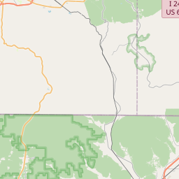
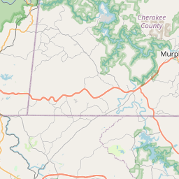
Leaflet | <a href="https://www.openstreetmap.org/copyright">© OpenStreetMap contributors</a>
Item
| Property | Value |
|---|---|
| id | 631803 |
| downstream_mainstem_id | https://geoconnex.us/ref/mainstems/370346 |
| encompassing_mainstem_basins | ['https://geoconnex.us/ref/mainstems/370346', 'https://geoconnex.us/ref/mainstems/316088', 'https://geoconnex.us/ref/mainstems/314849', 'https://geoconnex.us/ref/mainstems/312091'] |
| featuretype | ['https://www.opengis.net/def/schema/hy_features/hyf/HY_FlowPath', 'https://www.opengis.net/def/schema/hy_features/hyf/HY_WaterBody'] |
| fid | 10103 |
| head_2020huc12 | |
| head_nhdpv1_comid | 19695909 |
| head_nhdpv2_comid | https://geoconnex.us/nhdplusv2/comid/19695909 |
| head_nhdpv2huc12 | |
| head_rf1id | None |
| lengthkm | 12.7 |
| name_at_outlet | Friar Branch |
| name_at_outlet_gnis_id | 1284915 |
| new_mainstemid | |
| outlet_2020huc12 | |
| outlet_drainagearea_sqkm | 53.2 |
| outlet_nhdpv1_comid | 19695925 |
| outlet_nhdpv2_comid | https://geoconnex.us/nhdplusv2/comid/19695925 |
| outlet_nhdpv2huc12 | |
| outlet_rf1id | None |
| superseded | False |
| uri | https://geoconnex.us/ref/mainstems/631803 |
Graph Results
| monitoringLocation | https://sta.geoconnex.dev/collections/USGS/Things/items/'USGS-03567595' |
|---|---|
| siteName | USGS-03567595 |
| datasetDescription | Gage height feet / USGS-03567595-a000cd6262134596a822678dfe5d394e |
| type | Stream |
| url | https://waterdata.usgs.gov/monitoring-location/03567595/#parameterCode=00065 |
| variableMeasured | Gage height |
| variableUnit | ft |
| measurementTechnique | observation |
| temporalCoverage | 2024-08-30T09:15:00Z/2024-09-09T18:30:00Z |
| distributionName | USGS Instantaneous Values Service |
| distributionURL | https://waterservices.usgs.gov/nwis/iv/?sites=USGS:03567595¶meterCd=00065&format=rdb |
| distributionFormat | text/tab-separated-values |
| wkt | POINT (-85.1933777777778 35.0469861111111) |
| monitoringLocation | https://sta.geoconnex.dev/collections/USGS/Things/items/'USGS-03567595' |
|---|---|
| siteName | USGS-03567595 |
| datasetDescription | Gage height feet / USGS-03567595-a000cd6262134596a822678dfe5d394e |
| type | Stream |
| url | https://waterdata.usgs.gov/monitoring-location/03567595/#parameterCode=00065 |
| variableMeasured | Gage height |
| variableUnit | ft |
| measurementTechnique | observation |
| temporalCoverage | 2024-08-30T09:15:00Z/2024-09-09T18:30:00Z |
| distributionName | USGS SensorThings API |
| distributionURL | https://labs.waterdata.usgs.gov/sta/v1.1/Datastreams('a000cd6262134596a822678dfe5d394e')?$expand=Thing,Observations |
| distributionFormat | application/json |
| wkt | POINT (-85.1933777777778 35.0469861111111) |