BURNS PAIUTE
Map
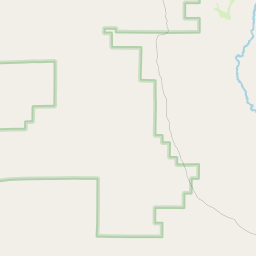
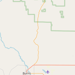
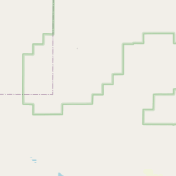
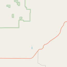
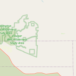

Leaflet | <a href="https://www.openstreetmap.org/copyright">© OpenStreetMap contributors</a>
Item
| Property | Value |
|---|---|
| id | 104101100 |
| boundary_type | Unknown Service Area - Using EPA ECHO facility location with buffered radius to represent PWS |
| centroid_lat | 43.611704 |
| centroid_lon | -119.066882 |
| centroid_quality | ECHO: INTERPOLATION-PHOTO |
| city_served | BURNS |
| contact_email | jess@gosimplelab.com |
| contribution_date | 2022-07-05 |
| county_served | None |
| data_source | SimpleLab |
| fid | 9728 |
| is_wholesaler_ind | False |
| owner_type_code | L |
| place_uri | https://geoconnex.us/ref/places/ |
| population_served_count | 155 |
| pred_05 | 792.662691684009 |
| pred_50 | 819.917252622127 |
| pred_95 | 848.108922244333 |
| primacy_agency_code | 10 |
| primacy_type | Tribal |
| primary_source_code | GW |
| primary_water_source | Groundwater |
| pws_name | BURNS PAIUTE |
| sdwis_link | https://enviro.epa.gov/enviro/sdw_report_v3.first_table?pws_id=104101100&state=10&source=0&population=0 |
| service_area_type | Residential Area |
| service_connections_count | 61 |
| source_date | 2022-07-05 |
| source_url | https://www.hydroshare.org/resource/b11b8982eebd4843833932f085f71d92/data/contents/temm.geojson |
| state_code | 10 |
| state_uri | None |
| tier | 3 |
| uri | https://geoconnex.us/ref/pws/104101100 |
| wholesaler | Is not a wholesaler |