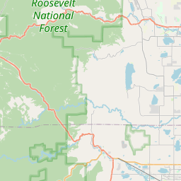
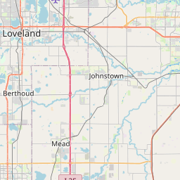
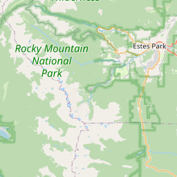
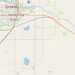
USGS NWIS Stream/River/Lake Site 06724000: ST. VRAIN CREEK AT LYONS, CO.
Map

Leaflet | <a href="https://www.openstreetmap.org/copyright">© OpenStreetMap contributors</a>
Item
| Property | Value |
|---|---|
| id | 1035239 |
| cluster | https://geoconnex.us/ref/gages/1189957 |
| dasqkm_diff | 1.20000000000005 |
| description | USGS NWIS Stream/River/Lake Site 06724000: ST. VRAIN CREEK AT LYONS, CO. |
| fid | 31093 |
| gage_totdasqkm | 559.4 |
| mainstem_uri | https://geoconnex.us/ref/mainstems/371269 |
| name | ST. VRAIN CREEK AT LYONS, CO. |
| nhdpv2_comid | 2888628.0 |
| nhdpv2_link_source | https://doi.org/10.5066/P9J5CK2Y |
| nhdpv2_offset_m | 2.66385012498178 |
| nhdpv2_reach_measure | 47.352 |
| nhdpv2_reachcode | 10190005000020 |
| nhdpv2_totdasqkm | 560.6 |
| nws_url | None |
| provider | https://waterdata.usgs.gov |
| provider_id | 06724000 |
| subjectof | https://waterdata.usgs.gov/monitoring-location/06724000 |
| uri | https://geoconnex.us/ref/gages/1035239 |