/
https://geoconnex.us/ref/hu08/10090208
JSON
JSON-LD
Resources
Collections
Processes
Documentation
Geoconnex Docs
API Definition
Conformance
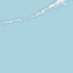
Little Powder
Map
+
−
Leaflet
| <a href="https://www.openstreetmap.org/copyright">© OpenStreetMap contributors</a>
Previous
Next
Item
Property
Value
id
10090208
fid
1305
gnis_id
None
gnis_url
hucs
https://geoconnex.us/ref/hu10/1009020801
https://geoconnex.us/ref/hu10/1009020802
https://geoconnex.us/ref/hu10/1009020803
https://geoconnex.us/ref/hu10/1009020804
https://geoconnex.us/ref/hu10/1009020805
https://geoconnex.us/ref/hu10/1009020806
https://geoconnex.us/ref/hu10/1009020807
https://geoconnex.us/iow/wqp/MONT_DEQ_WQX-2087LI01
https://geoconnex.us/iow/wqp/MDEQ_WQ_WQX-Y19LPR60
https://geoconnex.us/iow/wqp/MDEQ_WQ_WQX-Y19LPEFR01
https://geoconnex.us/iow/wqp/MDEQ_WQ_WQX-Y19LPR10
https://geoconnex.us/iow/wqp/MDEQ_WQ_WQX-Y19LPR20
https://geoconnex.us/iow/wqp/USGS-445458105273301
https://geoconnex.us/iow/wqp/USGS-442057105324901
https://geoconnex.us/iow/wqp/USGS-450740105055701
https://geoconnex.us/iow/wqp/USGS-443653105154301
https://geoconnex.us/iow/wqp/USGS-452126105153401
https://geoconnex.us/iow/wqp/USGS-443508105151601
https://geoconnex.us/iow/wqp/MDEQ_WQ_WQX-Y19LPR30
https://geoconnex.us/iow/wqp/NARS_WQX-FW08MT080
https://geoconnex.us/iow/wqp/USGS-442000105330001
https://geoconnex.us/iow/wqp/WYDEQ_WQX-NGP58
https://geoconnex.us/iow/wqp/USGS-444700105350801
https://geoconnex.us/iow/wqp/USGS-451210105200301
https://geoconnex.us/iow/wqp/USGS-442400105260001
https://geoconnex.us/iow/wqp/WYDEQ_WQX-NGP59
https://geoconnex.us/iow/wqp/USGS-444200105324001
https://geoconnex.us/iow/wqp/USGS-442636105335001
https://geoconnex.us/iow/wqp/USGS-06324925
https://geoconnex.us/iow/wqp/USGS-444429105423701
https://geoconnex.us/iow/wqp/USGS-444758105353302
https://geoconnex.us/iow/wqp/MDEQ_WQ_WQX-Y19LPR40
https://geoconnex.us/iow/wqp/NARS-WMTP99-0648
https://geoconnex.us/iow/wqp/USGS-06324790
https://geoconnex.us/iow/wqp/WYDEQ_WQX-NGP2
https://geoconnex.us/iow/wqp/WYDEQ_WQX-NGP60
https://geoconnex.us/iow/wqp/USGS-443000105143001
https://geoconnex.us/iow/wqp/USGS-444740105314701
https://geoconnex.us/iow/wqp/USGS-443500105200001
https://geoconnex.us/iow/wqp/USGS-444743105301201
https://geoconnex.us/iow/wqp/USGS-443352105394901
https://geoconnex.us/iow/wqp/USGS-442232105264101
https://geoconnex.us/iow/wqp/USGS-451446105192501
https://geoconnex.us/iow/wqp/USGS-444238105285201
https://geoconnex.us/iow/wqp/USGS-450745105055501
https://geoconnex.us/iow/wqp/USGS-442853105130201
https://geoconnex.us/iow/wqp/USGS-444110105210002
https://geoconnex.us/iow/wqp/USGS-444902105320701
https://geoconnex.us/iow/wqp/WYDEQ_WQX-NGPI30
https://geoconnex.us/iow/wqp/USGS-451412105195301
https://geoconnex.us/iow/wqp/USGS-442700105210001
https://geoconnex.us/iow/wqp/USGS-06324985
https://geoconnex.us/iow/wqp/USGS-442220105243001
https://geoconnex.us/iow/wqp/USGS-442700105342001
https://geoconnex.us/iow/wqp/WYDEQ_WATERSHED-NGPI29
https://geoconnex.us/iow/wqp/USGS-444826105263001
https://geoconnex.us/iow/wqp/USGS-443241105360801
https://geoconnex.us/iow/wqp/NARS_WQX-WYRO-1032
https://geoconnex.us/iow/wqp/USGS-451656105121601
https://geoconnex.us/iow/wqp/USGS-442300105103001
https://geoconnex.us/iow/wqp/USGS-444800105303401
https://geoconnex.us/iow/wqp/USGS-06325000
https://geoconnex.us/iow/wqp/USGS-442023105395701
https://geoconnex.us/iow/wqp/USGS-445444105190001
https://geoconnex.us/iow/wqp/USGS-443600105151601
https://geoconnex.us/iow/wqp/NARS_WQX-NRS_WY-10550
https://geoconnex.us/iow/wqp/USGS-443103105020001
https://geoconnex.us/iow/wqp/USGS-443457104122401
https://geoconnex.us/iow/wqp/USGS-442100105252001
https://geoconnex.us/iow/wqp/USGS-444305105273701
https://geoconnex.us/iow/wqp/USGS-443520105345001
https://geoconnex.us/iow/wqp/USGS-443846105430701
https://geoconnex.us/iow/wqp/USGS-442955105073701
https://geoconnex.us/iow/wqp/NARS_WQX-WMTP99-0648
https://geoconnex.us/iow/wqp/MONT_DEQ_WQX-2487LI01
https://geoconnex.us/iow/wqp/USGS-451835105103301
https://geoconnex.us/iow/wqp/USGS-444904105320201
https://geoconnex.us/iow/wqp/USGS-451508104591201
https://geoconnex.us/iow/wqp/USGS-452019105135401
https://geoconnex.us/iow/wqp/USGS-441800105320001
https://geoconnex.us/iow/wqp/USGS-442329105284701
https://geoconnex.us/iow/wqp/USGS-442955105053101
https://geoconnex.us/iow/wqp/USGS-443141105325001
https://geoconnex.us/iow/wqp/USGS-445440105152001
https://geoconnex.us/iow/wqp/USGS-443210105171001
https://geoconnex.us/iow/wqp/USGS-451556105021301
https://geoconnex.us/iow/wqp/USGS-443135105312901
https://geoconnex.us/iow/wqp/WYDEQ_WQX-NGP1
https://geoconnex.us/iow/wqp/USGS-443130105141001
https://geoconnex.us/iow/wqp/USGS-06324912
https://geoconnex.us/iow/wqp/USGS-442109105080801
https://geoconnex.us/iow/wqp/USGS-06324918
https://geoconnex.us/iow/wqp/MDEQ_WQ_WQX-Y19LPR50
https://geoconnex.us/iow/wqp/MDEQ_WQ_WQX-Y19LTPR3-2
https://geoconnex.us/iow/wqp/NARS_WQX-NRS_MT-10559
https://geoconnex.us/iow/wqp/USGS-06324965
https://geoconnex.us/iow/wqp/USGS-451956105023901
https://geoconnex.us/iow/wqp/WYDEQ_WATERSHED-NGP1
https://geoconnex.us/iow/wqp/USGS-06325550
https://geoconnex.us/iow/wqp/WYDEQ_WATERSHED-NGP145
https://geoconnex.us/iow/wqp/WYDEQ_WQX-NGP61
https://geoconnex.us/iow/wqp/USGS-451626105020801
https://geoconnex.us/iow/wqp/USGS-06324870
https://geoconnex.us/iow/wqp/USGS-444806105324201
https://geoconnex.us/iow/wqp/USGS-445920105345001
https://geoconnex.us/iow/wqp/USGS-443230105150001
https://geoconnex.us/iow/wqp/USGS-444328105362701
https://geoconnex.us/iow/wqp/USGS-444842105352201
https://geoconnex.us/iow/wqp/USGS-444828105262301
https://geoconnex.us/iow/wqp/USGS-441836105371201
https://geoconnex.us/iow/wqp/USGS-444828105262802
https://geoconnex.us/iow/wqp/USGS-442240105230001
https://geoconnex.us/iow/wqp/USGS-443320105150001
https://geoconnex.us/iow/wqp/WYDEQ_WQX-NGPI29
https://geoconnex.us/iow/wqp/USGS-443343105400801
https://geoconnex.us/iow/wqp/USGS-444500105135001
https://geoconnex.us/iow/wqp/USGS-443535105185000
https://geoconnex.us/iow/wqp/USGS-442108105095601
https://geoconnex.us/iow/wqp/NARS_WQX-NRS_MT-10323
https://geoconnex.us/iow/wqp/USGS-442320105105001
https://geoconnex.us/iow/wqp/USGS-451825105172201
https://geoconnex.us/iow/wqp/USGS-442210105323001
https://geoconnex.us/iow/wqp/WYDEQ_WATERSHED-NGP2
https://geoconnex.us/iow/wqp/USGS-444900105332301
https://geoconnex.us/iow/wqp/USGS-06324890
https://geoconnex.us/iow/wqp/USGS-06324950
https://geoconnex.us/iow/wqp/USGS-445810105123001
https://geoconnex.us/iow/wqp/USGS-451956105060301
https://geoconnex.us/iow/wqp/USGS-444740105302001
https://geoconnex.us/iow/wqp/USGS-444950105222001
https://geoconnex.us/iow/wqp/NARS_WQX-MTS9-0938
https://geoconnex.us/iow/wqp/USGS-06324785
https://geoconnex.us/iow/wqp/USGS-442227105093801
https://geoconnex.us/iow/wqp/USGS-444020105164001
https://geoconnex.us/iow/wqp/USGS-451623105013101
https://geoconnex.us/iow/wqp/USGS-444924105314301
https://geoconnex.us/iow/wqp/USGS-442300105302001
https://geoconnex.us/iow/wqp/USGS-444826105263002
https://geoconnex.us/iow/wqp/USGS-444750105153001
https://geoconnex.us/iow/wqp/WYDEQ_WATERSHED-NGP58
https://geoconnex.us/iow/wqp/USGS-06324902
https://geoconnex.us/iow/wqp/WYDEQ_WATERSHED-NGPI30
https://geoconnex.us/iow/wqp/USGS-450852105243701
https://geoconnex.us/iow/wqp/USGS-442530105084401
https://geoconnex.us/iow/wqp/USGS-443200105431001
https://geoconnex.us/iow/wqp/NARS_WQX-WYR9-0905
https://geoconnex.us/iow/wqp/USGS-443830105191001
https://geoconnex.us/iow/wqp/USGS-443241105360802
https://geoconnex.us/iow/wqp/MONT_DEQ_WQX-2189EA01
https://geoconnex.us/iow/wqp/WYDEQ_WATERSHED-NGP60
https://geoconnex.us/iow/wqp/WYDEQ_WQX-NGP145
https://geoconnex.us/iow/wqp/USGS-443115105422901
https://geoconnex.us/iow/wqp/WYDEQ_WATERSHED-NGP59
https://geoconnex.us/iow/wqp/USGS-450208105282601
https://geoconnex.us/iow/wqp/NARS_WQX-NRS_WY-10417
https://geoconnex.us/iow/wqp/USGS-06324830
https://geoconnex.us/iow/wqp/USGS-444758105353303
https://geoconnex.us/iow/wqp/USGS-444759105273601
https://geoconnex.us/iow/wqp/USGS-450247105123001
https://geoconnex.us/iow/wqp/USGS-445600105220001
https://geoconnex.us/iow/wqp/USGS-445034105311001
https://geoconnex.us/iow/wqp/USGS-445329105312801
https://geoconnex.us/iow/wqp/USGS-06324940
https://geoconnex.us/iow/wqp/USGS-443552105341401
https://geoconnex.us/iow/wqp/USGS-444110105210001
https://geoconnex.us/iow/wqp/USGS-443140105154001
https://geoconnex.us/iow/wqp/USGS-443402105372801
https://geoconnex.us/iow/wqp/USGS-442712105101501
https://geoconnex.us/iow/wqp/MONT_DEQ_WQX-2387EA01
https://geoconnex.us/iow/wqp/USGS-442730105130001
https://geoconnex.us/iow/wqp/USGS-445900105202001
https://geoconnex.us/iow/wqp/USGS-445213105091501
https://geoconnex.us/iow/wqp/USGS-442911105210801
https://geoconnex.us/iow/wqp/USGS-442250105213001
https://geoconnex.us/iow/wqp/USGS-443330105345001
https://geoconnex.us/iow/wqp/USGS-442609105272000
https://geoconnex.us/iow/wqp/NARS_WQX-FW08WY026
https://geoconnex.us/iow/wqp/USGS-06325500
https://geoconnex.us/iow/wqp/MONT_DEQ_WQX-2387LI01
https://geoconnex.us/iow/wqp/NARS-WMTP99-0642
https://geoconnex.us/iow/wqp/USGS-444650105140001
https://geoconnex.us/iow/wqp/WYDEQ_WATERSHED-NGP61
https://geoconnex.us/iow/wqp/USGS-445910105211001
https://geoconnex.us/iow/wqp/USGS-452018105032801
https://geoconnex.us/iow/wqp/USGS-442055105315801
https://geoconnex.us/iow/wqp/USGS-444834105323001
loaddate
2012-06-11 12:54:56+00:00
name
Little Powder
uri
https://geoconnex.us/ref/hu08/10090208