/
https://geoconnex.us/ref/hu08/10090209
JSON
JSON-LD
Resources
Collections
Processes
Documentation
Geoconnex Docs
API Definition
Conformance
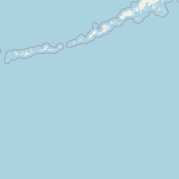
Lower Powder
Map
+
−
Leaflet
| <a href="https://www.openstreetmap.org/copyright">© OpenStreetMap contributors</a>
Previous
Next
Item
Property
Value
id
10090209
fid
2047
gnis_id
None
gnis_url
hucs
https://geoconnex.us/ref/hu10/1009020901
https://geoconnex.us/ref/hu10/1009020902
https://geoconnex.us/ref/hu10/1009020903
https://geoconnex.us/ref/hu10/1009020904
https://geoconnex.us/ref/hu10/1009020905
https://geoconnex.us/ref/hu10/1009020906
https://geoconnex.us/ref/hu10/1009020907
https://geoconnex.us/ref/hu10/1009020908
https://geoconnex.us/ref/hu10/1009020909
https://geoconnex.us/ref/hu10/1009020910
https://geoconnex.us/ref/hu10/1009020911
https://geoconnex.us/ref/hu10/1009020912
https://geoconnex.us/ref/hu10/1009020913
https://geoconnex.us/iow/wqp/USGS-06326000
https://geoconnex.us/iow/wqp/MDEQ_WQ_WQX-Y21POWDR01
https://geoconnex.us/iow/wqp/MDEQ_WQ_WQX-Y21CROWC01
https://geoconnex.us/iow/wqp/NARS_WQX-NWC_MT-10195
https://geoconnex.us/iow/wqp/USGS-462037105031501
https://geoconnex.us/iow/wqp/NARS_WQX-MTRO-1065
https://geoconnex.us/iow/wqp/USGS-461206105075401
https://geoconnex.us/iow/wqp/NARS_WQX-NLA_MT-10179
https://geoconnex.us/iow/wqp/MONT_DEQ_WQX-2688CR01
https://geoconnex.us/iow/wqp/MONT_DEQ_WQX-2789PO01
https://geoconnex.us/iow/wqp/USGS-453515105031202
https://geoconnex.us/iow/wqp/USGS-460850105042301
https://geoconnex.us/iow/wqp/MDEQ_WQ_WQX-Y21PR10
https://geoconnex.us/iow/wqp/USGS-462746105075901
https://geoconnex.us/iow/wqp/MDEQ_WQ_WQX-Y21PR20
https://geoconnex.us/iow/wqp/MONT_DEQ_WQX-3487PO01
https://geoconnex.us/iow/wqp/NARS-WMTP99-0537
https://geoconnex.us/iow/wqp/USGS-461748105161301
https://geoconnex.us/iow/wqp/NARS_WQX-NRS_MT-10505
https://geoconnex.us/iow/wqp/USGS-453611105030401
https://geoconnex.us/iow/wqp/USGS-462023105032901
https://geoconnex.us/iow/wqp/USGS-462535105173601
https://geoconnex.us/iow/wqp/USGS-455706105040701
https://geoconnex.us/iow/wqp/USGS-460922105091001
https://geoconnex.us/iow/wqp/USGS-454612105023001
https://geoconnex.us/iow/wqp/MDEQ_WQ_WQX-Y21PR30
https://geoconnex.us/iow/wqp/MDEQ_WQ_WQX-Y21PR40
https://geoconnex.us/iow/wqp/USGS-462230105000001
https://geoconnex.us/iow/wqp/USGS-461727105252801
https://geoconnex.us/iow/wqp/USGS-461948105040801
https://geoconnex.us/iow/wqp/USGS-464422105253101
https://geoconnex.us/iow/wqp/USGS-461948105083301
https://geoconnex.us/iow/wqp/USGS-462016105113701
https://geoconnex.us/iow/wqp/MDEQ_WQ_WQX-Y21PWDRR01
https://geoconnex.us/iow/wqp/MDEQ_WQ_WQX-Y21PWDRR03
https://geoconnex.us/iow/wqp/USGS-454723105053901
https://geoconnex.us/iow/wqp/USGS-460739105081001
https://geoconnex.us/iow/wqp/USGS-453828105104901
https://geoconnex.us/iow/wqp/USGS-462411105203301
https://geoconnex.us/iow/wqp/USGS-462614105115201
https://geoconnex.us/iow/wqp/USGS-460821105081501
https://geoconnex.us/iow/wqp/USGS-461417105042501
https://geoconnex.us/iow/wqp/USGS-06326507
https://geoconnex.us/iow/wqp/MDEQ_WQ_WQX-Y21PWDRR04
https://geoconnex.us/iow/wqp/USGS-453209105201201
https://geoconnex.us/iow/wqp/USGS-454447105054501
https://geoconnex.us/iow/wqp/USGS-462450105053801
https://geoconnex.us/iow/wqp/MDEQ_WQ_WQX-Y21PWR15-3
https://geoconnex.us/iow/wqp/MONT_DEQ_WQX-3985PO01
https://geoconnex.us/iow/wqp/USGS-452434105045701
https://geoconnex.us/iow/wqp/MONT_DEQ_WQX-3686PO01
https://geoconnex.us/iow/wqp/USGS-454313105123701
https://geoconnex.us/iow/wqp/USGS-462738105191501
https://geoconnex.us/iow/wqp/USGS-461725105215301
https://geoconnex.us/iow/wqp/USGS-453838105154201
https://geoconnex.us/iow/wqp/USGS-06325650
https://geoconnex.us/iow/wqp/USGS-452912105212401
https://geoconnex.us/iow/wqp/USGS-462501105190701
https://geoconnex.us/iow/wqp/USGS-460012105122001
https://geoconnex.us/iow/wqp/USGS-461633105075101
https://geoconnex.us/iow/wqp/USGS-453840105154201
https://geoconnex.us/iow/wqp/USGS-454323105035101
https://geoconnex.us/iow/wqp/MONT_DEQ_WQX-2487PO02
https://geoconnex.us/iow/wqp/MONT_DEQ_WQX-3487SH01
https://geoconnex.us/iow/wqp/OST_SHPD-NRS18_MT_10064
https://geoconnex.us/iow/wqp/USGS-454004105060601
https://geoconnex.us/iow/wqp/USGS-460802105055701
https://geoconnex.us/iow/wqp/USGS-463027105185401
https://geoconnex.us/iow/wqp/USGS-461457105154401
https://geoconnex.us/iow/wqp/USGS-06326500
https://geoconnex.us/iow/wqp/NARS_WQX-NRS_MT-10393
https://geoconnex.us/iow/wqp/USGS-460408105052501
https://geoconnex.us/iow/wqp/USGS-462736105191801
https://geoconnex.us/iow/wqp/USGS-06326520
https://geoconnex.us/iow/wqp/USGS-454510105034401
https://geoconnex.us/iow/wqp/USGS-452914105172501
https://geoconnex.us/iow/wqp/MDEQ_WQ_WQX-Y21STMPC01
loaddate
2012-06-11 12:54:56+00:00
name
Lower Powder
uri
https://geoconnex.us/ref/hu08/10090209