Blackfoot River
Map

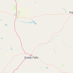


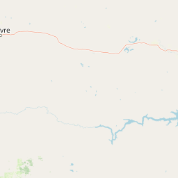


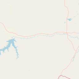

Leaflet | <a href="https://www.openstreetmap.org/copyright">© OpenStreetMap contributors</a>
Item
| Property | Value |
|---|---|
| id | 1428490 |
| downstream_mainstem_id | https://geoconnex.us/ref/mainstems/1423587 |
| encompassing_mainstem_basins | ['https://geoconnex.us/ref/mainstems/1423587'] |
| featuretype | ['https://www.opengis.net/def/schema/hy_features/hyf/HY_FlowPath', 'https://www.opengis.net/def/schema/hy_features/hyf/HY_WaterBody'] |
| fid | 28660 |
| head_2020huc12 | 170102030202 |
| head_nhdpv1_comid | 22916538 |
| head_nhdpv2_comid | https://geoconnex.us/nhdplusv2/comid/22916538 |
| head_nhdpv2huc12 | https://geoconnex.us/nhdplusv2/huc12/170102030202 |
| head_rf1id | 45887 |
| lengthkm | 209.1 |
| name_at_outlet | Blackfoot River |
| name_at_outlet_gnis_id | 800475 |
| new_mainstemid | |
| outlet_2020huc12 | 170102031308 |
| outlet_drainagearea_sqkm | 5921.3 |
| outlet_nhdpv1_comid | 22911954 |
| outlet_nhdpv2_comid | https://geoconnex.us/nhdplusv2/comid/22911954 |
| outlet_nhdpv2huc12 | https://geoconnex.us/nhdplusv2/huc12/170102031308 |
| outlet_rf1id | 46770 |
| superseded | False |
| uri | https://geoconnex.us/ref/mainstems/1428490 |
Graph Results
| monitoringLocation | https://sta.geoconnex.dev/collections/USGS/Things/items/'USGS-12335100' |
|---|---|
| siteName | USGS-12335100 |
| datasetDescription | Discharge / USGS-12335100-8834bca961ef4451b08536ace3c9cea1 |
| type | Stream |
| url | https://waterdata.usgs.gov/monitoring-location/12335100/#parameterCode=00060 |
| variableMeasured | Discharge / USGS-12335100-8834bca961ef4451b08536ace3c9cea1 |
| variableUnit | ft^3/s |
| measurementTechnique | observation |
| temporalCoverage | 2024-08-30T09:15:00Z/2024-09-09T18:45:00Z |
| distributionName | USGS Instantaneous Values Service |
| distributionURL | https://waterservices.usgs.gov/nwis/iv/?sites=USGS:12335100¶meterCd=00060&format=rdb |
| distributionFormat | text/tab-separated-values |
| wkt | POINT (-113.014986111111 46.9187944444444) |
| monitoringLocation | https://sta.geoconnex.dev/collections/USGS/Things/items/'USGS-12335100' |
|---|---|
| siteName | USGS-12335100 |
| datasetDescription | Discharge / USGS-12335100-8834bca961ef4451b08536ace3c9cea1 |
| type | Stream |
| url | https://waterdata.usgs.gov/monitoring-location/12335100/#parameterCode=00060 |
| variableMeasured | Discharge / USGS-12335100-8834bca961ef4451b08536ace3c9cea1 |
| variableUnit | ft^3/s |
| measurementTechnique | observation |
| temporalCoverage | 2024-08-30T09:15:00Z/2024-09-09T18:45:00Z |
| distributionName | USGS SensorThings API |
| distributionURL | https://labs.waterdata.usgs.gov/sta/v1.1/Datastreams('8834bca961ef4451b08536ace3c9cea1')?$expand=Thing,Observations |
| distributionFormat | application/json |
| wkt | POINT (-113.014986111111 46.9187944444444) |
| monitoringLocation | https://sta.geoconnex.dev/collections/USGS/Things/items/'USGS-12335100' |
|---|---|
| siteName | USGS-12335100 |
| datasetDescription | Gage height feet / USGS-12335100-a3c5bf866ecc4317b2f2de5598036840 |
| type | Stream |
| url | https://waterdata.usgs.gov/monitoring-location/12335100/#parameterCode=00065 |
| variableMeasured | Gage height |
| variableUnit | ft |
| measurementTechnique | observation |
| temporalCoverage | 2024-08-30T09:15:00Z/2024-09-09T18:45:00Z |
| distributionName | USGS Instantaneous Values Service |
| distributionURL | https://waterservices.usgs.gov/nwis/iv/?sites=USGS:12335100¶meterCd=00065&format=rdb |
| distributionFormat | text/tab-separated-values |
| wkt | POINT (-113.014986111111 46.9187944444444) |
| monitoringLocation | https://sta.geoconnex.dev/collections/USGS/Things/items/'USGS-12335100' |
|---|---|
| siteName | USGS-12335100 |
| datasetDescription | Gage height feet / USGS-12335100-a3c5bf866ecc4317b2f2de5598036840 |
| type | Stream |
| url | https://waterdata.usgs.gov/monitoring-location/12335100/#parameterCode=00065 |
| variableMeasured | Gage height |
| variableUnit | ft |
| measurementTechnique | observation |
| temporalCoverage | 2024-08-30T09:15:00Z/2024-09-09T18:45:00Z |
| distributionName | USGS SensorThings API |
| distributionURL | https://labs.waterdata.usgs.gov/sta/v1.1/Datastreams('a3c5bf866ecc4317b2f2de5598036840')?$expand=Thing,Observations |
| distributionFormat | application/json |
| wkt | POINT (-113.014986111111 46.9187944444444) |