South Branch River Raisin
Map
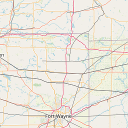
Leaflet | <a href="https://www.openstreetmap.org/copyright">© OpenStreetMap contributors</a>
Item
| Property | Value |
|---|---|
| id | 2060105 |
| downstream_mainstem_id | https://geoconnex.us/ref/mainstems/2060002 |
| encompassing_mainstem_basins | ['https://geoconnex.us/ref/mainstems/2060002'] |
| featuretype | ['https://www.opengis.net/def/schema/hy_features/hyf/HY_FlowPath', 'https://www.opengis.net/def/schema/hy_features/hyf/HY_WaterBody'] |
| fid | 7071 |
| head_2020huc12 | 041000020202 |
| head_nhdpv1_comid | 13230362 |
| head_nhdpv2_comid | https://geoconnex.us/nhdplusv2/comid/13230362 |
| head_nhdpv2huc12 | https://geoconnex.us/nhdplusv2/huc12/041000020202 |
| head_rf1id | 11215 |
| lengthkm | 50.8 |
| name_at_outlet | South Branch River Raisin |
| name_at_outlet_gnis_id | 638307 |
| new_mainstemid | |
| outlet_2020huc12 | 041000020206 |
| outlet_drainagearea_sqkm | 493.3 |
| outlet_nhdpv1_comid | 13229038 |
| outlet_nhdpv2_comid | https://geoconnex.us/nhdplusv2/comid/13229038 |
| outlet_nhdpv2huc12 | https://geoconnex.us/nhdplusv2/huc12/041000020206 |
| outlet_rf1id | 11213 |
| superseded | False |
| uri | https://geoconnex.us/ref/mainstems/2060105 |
Graph Results
| monitoringLocation | https://sta.geoconnex.dev/collections/USGS/Things/items/'USGS-04175748' |
|---|---|
| siteName | USGS-04175748 |
| datasetDescription | Discharge cubic feet per second / USGS-04175748-2df40cb8c00c4ca59538461486da5306 |
| type | Stream |
| url | https://waterdata.usgs.gov/monitoring-location/04175748/#parameterCode=00060 |
| variableMeasured | Discharge |
| variableUnit | ft^3/s |
| measurementTechnique | observation |
| temporalCoverage | 2024-08-30T09:15:00Z/2024-09-09T18:00:00Z |
| distributionName | USGS Instantaneous Values Service |
| distributionURL | https://waterservices.usgs.gov/nwis/iv/?sites=USGS:04175748¶meterCd=00060&format=rdb |
| distributionFormat | text/tab-separated-values |
| wkt | POINT (-84.15969444444445 41.85796111111111) |
| monitoringLocation | https://sta.geoconnex.dev/collections/USGS/Things/items/'USGS-04175748' |
|---|---|
| siteName | USGS-04175748 |
| datasetDescription | Discharge cubic feet per second / USGS-04175748-2df40cb8c00c4ca59538461486da5306 |
| type | Stream |
| url | https://waterdata.usgs.gov/monitoring-location/04175748/#parameterCode=00060 |
| variableMeasured | Discharge |
| variableUnit | ft^3/s |
| measurementTechnique | observation |
| temporalCoverage | 2024-08-30T09:15:00Z/2024-09-09T18:00:00Z |
| distributionName | USGS SensorThings API |
| distributionURL | https://labs.waterdata.usgs.gov/sta/v1.1/Datastreams('2df40cb8c00c4ca59538461486da5306')?$expand=Thing,Observations |
| distributionFormat | application/json |
| wkt | POINT (-84.15969444444445 41.85796111111111) |
| monitoringLocation | https://sta.geoconnex.dev/collections/USGS/Things/items/'USGS-04175748' |
|---|---|
| siteName | USGS-04175748 |
| datasetDescription | Gage height / USGS-04175748-6fb202ff3ea74620a68f79e6005a5e74 |
| type | Stream |
| url | https://waterdata.usgs.gov/monitoring-location/04175748/#parameterCode=00065 |
| variableMeasured | Gage height / USGS-04175748-6fb202ff3ea74620a68f79e6005a5e74 |
| variableUnit | ft |
| measurementTechnique | observation |
| temporalCoverage | 2024-08-30T09:15:00Z/2024-09-09T18:00:00Z |
| distributionName | USGS Instantaneous Values Service |
| distributionURL | https://waterservices.usgs.gov/nwis/iv/?sites=USGS:04175748¶meterCd=00065&format=rdb |
| distributionFormat | text/tab-separated-values |
| wkt | POINT (-84.15969444444445 41.85796111111111) |
| monitoringLocation | https://sta.geoconnex.dev/collections/USGS/Things/items/'USGS-04175748' |
|---|---|
| siteName | USGS-04175748 |
| datasetDescription | Gage height / USGS-04175748-6fb202ff3ea74620a68f79e6005a5e74 |
| type | Stream |
| url | https://waterdata.usgs.gov/monitoring-location/04175748/#parameterCode=00065 |
| variableMeasured | Gage height / USGS-04175748-6fb202ff3ea74620a68f79e6005a5e74 |
| variableUnit | ft |
| measurementTechnique | observation |
| temporalCoverage | 2024-08-30T09:15:00Z/2024-09-09T18:00:00Z |
| distributionName | USGS SensorThings API |
| distributionURL | https://labs.waterdata.usgs.gov/sta/v1.1/Datastreams('6fb202ff3ea74620a68f79e6005a5e74')?$expand=Thing,Observations |
| distributionFormat | application/json |
| wkt | POINT (-84.15969444444445 41.85796111111111) |
| monitoringLocation | https://sta.geoconnex.dev/collections/USGS/Things/items/'USGS-04175748' |
|---|---|
| siteName | USGS-04175748 |
| datasetDescription | Stream water level elevation above NAVD 1988 in feet / USGS-04175748-f84a88f8e24f46e9b9c45adfb51b68a5 |
| type | Stream |
| url | https://waterdata.usgs.gov/monitoring-location/04175748/#parameterCode=63160 |
| variableMeasured | Stream water level elevation above NAVD 1988 |
| variableUnit | ft |
| measurementTechnique | observation |
| temporalCoverage | 2024-08-30T09:15:00Z/2024-09-09T18:00:00Z |
| distributionName | USGS Instantaneous Values Service |
| distributionURL | https://waterservices.usgs.gov/nwis/iv/?sites=USGS:04175748¶meterCd=63160&format=rdb |
| distributionFormat | text/tab-separated-values |
| wkt | POINT (-84.15969444444445 41.85796111111111) |
| monitoringLocation | https://sta.geoconnex.dev/collections/USGS/Things/items/'USGS-04175748' |
|---|---|
| siteName | USGS-04175748 |
| datasetDescription | Stream water level elevation above NAVD 1988 in feet / USGS-04175748-f84a88f8e24f46e9b9c45adfb51b68a5 |
| type | Stream |
| url | https://waterdata.usgs.gov/monitoring-location/04175748/#parameterCode=63160 |
| variableMeasured | Stream water level elevation above NAVD 1988 |
| variableUnit | ft |
| measurementTechnique | observation |
| temporalCoverage | 2024-08-30T09:15:00Z/2024-09-09T18:00:00Z |
| distributionName | USGS SensorThings API |
| distributionURL | https://labs.waterdata.usgs.gov/sta/v1.1/Datastreams('f84a88f8e24f46e9b9c45adfb51b68a5')?$expand=Thing,Observations |
| distributionFormat | application/json |
| wkt | POINT (-84.15969444444445 41.85796111111111) |