Wolf River
Map
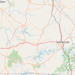
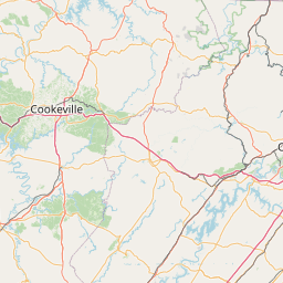
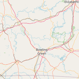
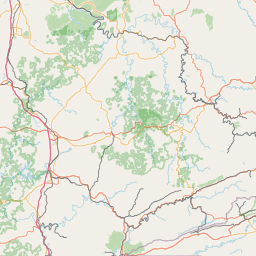
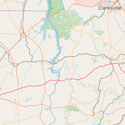
Leaflet | <a href="https://www.openstreetmap.org/copyright">© OpenStreetMap contributors</a>
Item
| Property | Value |
|---|---|
| id | 400129 |
| downstream_mainstem_id | https://geoconnex.us/ref/mainstems/363531 |
| encompassing_mainstem_basins | ['https://geoconnex.us/ref/mainstems/363531', 'https://geoconnex.us/ref/mainstems/319580', 'https://geoconnex.us/ref/mainstems/314849', 'https://geoconnex.us/ref/mainstems/312091'] |
| featuretype | ['https://www.opengis.net/def/schema/hy_features/hyf/HY_FlowPath', 'https://www.opengis.net/def/schema/hy_features/hyf/HY_WaterBody'] |
| fid | 9502 |
| head_2020huc12 | 051301050401 |
| head_nhdpv1_comid | 10182181 |
| head_nhdpv2_comid | https://geoconnex.us/nhdplusv2/comid/10182181 |
| head_nhdpv2huc12 | https://geoconnex.us/nhdplusv2/huc12/051301050401 |
| head_rf1id | 15275 |
| lengthkm | 73.8 |
| name_at_outlet | Wolf River |
| name_at_outlet_gnis_id | 507027 |
| new_mainstemid | |
| outlet_2020huc12 | 051301050406 |
| outlet_drainagearea_sqkm | 745.4 |
| outlet_nhdpv1_comid | 10181925 |
| outlet_nhdpv2_comid | https://geoconnex.us/nhdplusv2/comid/10181925 |
| outlet_nhdpv2huc12 | https://geoconnex.us/nhdplusv2/huc12/051301050406 |
| outlet_rf1id | 15898 |
| superseded | False |
| uri | https://geoconnex.us/ref/mainstems/400129 |
Graph Results
| monitoringLocation | https://sta.geoconnex.dev/collections/USGS/Things/items/'USGS-03416000' |
|---|---|
| siteName | USGS-03416000 |
| datasetDescription | Gage height / USGS-03416000-dec7a07284fd4019bc48e5df03be2419 |
| type | Stream |
| url | https://waterdata.usgs.gov/monitoring-location/03416000/#parameterCode=00065 |
| variableMeasured | Gage height / USGS-03416000-dec7a07284fd4019bc48e5df03be2419 |
| variableUnit | ft |
| measurementTechnique | observation |
| temporalCoverage | 2024-08-30T09:30:00Z/2024-09-09T18:00:00Z |
| distributionName | USGS SensorThings API |
| distributionURL | https://labs.waterdata.usgs.gov/sta/v1.1/Datastreams('dec7a07284fd4019bc48e5df03be2419')?$expand=Thing,Observations |
| distributionFormat | application/json |
| wkt | POINT (-85.073007314474 36.5603446997792) |
| monitoringLocation | https://sta.geoconnex.dev/collections/USGS/Things/items/'USGS-03416000' |
|---|---|
| siteName | USGS-03416000 |
| datasetDescription | Gage height / USGS-03416000-dec7a07284fd4019bc48e5df03be2419 |
| type | Stream |
| url | https://waterdata.usgs.gov/monitoring-location/03416000/#parameterCode=00065 |
| variableMeasured | Gage height / USGS-03416000-dec7a07284fd4019bc48e5df03be2419 |
| variableUnit | ft |
| measurementTechnique | observation |
| temporalCoverage | 2024-08-30T09:30:00Z/2024-09-09T18:00:00Z |
| distributionName | USGS Instantaneous Values Service |
| distributionURL | https://waterservices.usgs.gov/nwis/iv/?sites=USGS:03416000¶meterCd=00065&format=rdb |
| distributionFormat | text/tab-separated-values |
| wkt | POINT (-85.073007314474 36.5603446997792) |
| monitoringLocation | https://sta.geoconnex.dev/collections/USGS/Things/items/'USGS-03416000' |
|---|---|
| siteName | USGS-03416000 |
| datasetDescription | Discharge cubic feet per second / USGS-03416000-b96846bc1ffc40d882cb689e70380e43 |
| type | Stream |
| url | https://waterdata.usgs.gov/monitoring-location/03416000/#parameterCode=00060 |
| variableMeasured | Discharge |
| variableUnit | ft^3/s |
| measurementTechnique | observation |
| temporalCoverage | 2024-08-30T09:30:00Z/2024-09-09T18:00:00Z |
| distributionName | USGS Instantaneous Values Service |
| distributionURL | https://waterservices.usgs.gov/nwis/iv/?sites=USGS:03416000¶meterCd=00060&format=rdb |
| distributionFormat | text/tab-separated-values |
| wkt | POINT (-85.073007314474 36.5603446997792) |
| monitoringLocation | https://sta.geoconnex.dev/collections/USGS/Things/items/'USGS-03416000' |
|---|---|
| siteName | USGS-03416000 |
| datasetDescription | Discharge cubic feet per second / USGS-03416000-b96846bc1ffc40d882cb689e70380e43 |
| type | Stream |
| url | https://waterdata.usgs.gov/monitoring-location/03416000/#parameterCode=00060 |
| variableMeasured | Discharge |
| variableUnit | ft^3/s |
| measurementTechnique | observation |
| temporalCoverage | 2024-08-30T09:30:00Z/2024-09-09T18:00:00Z |
| distributionName | USGS SensorThings API |
| distributionURL | https://labs.waterdata.usgs.gov/sta/v1.1/Datastreams('b96846bc1ffc40d882cb689e70380e43')?$expand=Thing,Observations |
| distributionFormat | application/json |
| wkt | POINT (-85.073007314474 36.5603446997792) |