Clear Fork
Map


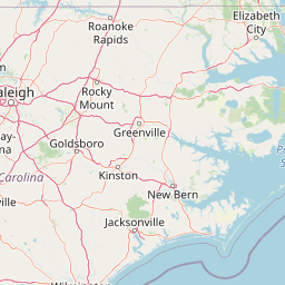
Leaflet | <a href="https://www.openstreetmap.org/copyright">© OpenStreetMap contributors</a>
Item
| Property | Value |
|---|---|
| id | 400130 |
| downstream_mainstem_id | https://geoconnex.us/ref/mainstems/352284 |
| encompassing_mainstem_basins | ['https://geoconnex.us/ref/mainstems/352284', 'https://geoconnex.us/ref/mainstems/319580', 'https://geoconnex.us/ref/mainstems/314849', 'https://geoconnex.us/ref/mainstems/312091'] |
| featuretype | ['https://www.opengis.net/def/schema/hy_features/hyf/HY_FlowPath', 'https://www.opengis.net/def/schema/hy_features/hyf/HY_WaterBody'] |
| fid | 9479 |
| head_2020huc12 | 051301040202 |
| head_nhdpv1_comid | 12154018 |
| head_nhdpv2_comid | https://geoconnex.us/nhdplusv2/comid/12154018 |
| head_nhdpv2huc12 | https://geoconnex.us/nhdplusv2/huc12/051301040202 |
| head_rf1id | 15236 |
| lengthkm | 72.3 |
| name_at_outlet | Clear Fork |
| name_at_outlet_gnis_id | 1305959 |
| new_mainstemid | |
| outlet_2020huc12 | 051301040205 |
| outlet_drainagearea_sqkm | 733.8 |
| outlet_nhdpv1_comid | 12154428 |
| outlet_nhdpv2_comid | https://geoconnex.us/nhdplusv2/comid/12154428 |
| outlet_nhdpv2huc12 | https://geoconnex.us/nhdplusv2/huc12/051301040205 |
| outlet_rf1id | 15231 |
| superseded | False |
| uri | https://geoconnex.us/ref/mainstems/400130 |
Graph Results
| monitoringLocation | https://sta.geoconnex.dev/collections/USGS/Things/items/'USGS-03409500' |
|---|---|
| siteName | USGS-03409500 |
| datasetDescription | Discharge / USGS-03409500-43f1150324ee40c0b14fe4443a0d35d7 |
| type | Stream |
| url | https://waterdata.usgs.gov/monitoring-location/03409500/#parameterCode=00060 |
| variableMeasured | Discharge / USGS-03409500-43f1150324ee40c0b14fe4443a0d35d7 |
| variableUnit | ft^3/s |
| measurementTechnique | observation |
| temporalCoverage | 2024-08-30T09:30:00Z/2024-09-09T18:30:00Z |
| distributionName | USGS Instantaneous Values Service |
| distributionURL | https://waterservices.usgs.gov/nwis/iv/?sites=USGS:03409500¶meterCd=00060&format=rdb |
| distributionFormat | text/tab-separated-values |
| wkt | POINT (-84.63016910789818 36.38829774770187) |
| monitoringLocation | https://sta.geoconnex.dev/collections/USGS/Things/items/'USGS-03409500' |
|---|---|
| siteName | USGS-03409500 |
| datasetDescription | Discharge / USGS-03409500-43f1150324ee40c0b14fe4443a0d35d7 |
| type | Stream |
| url | https://waterdata.usgs.gov/monitoring-location/03409500/#parameterCode=00060 |
| variableMeasured | Discharge / USGS-03409500-43f1150324ee40c0b14fe4443a0d35d7 |
| variableUnit | ft^3/s |
| measurementTechnique | observation |
| temporalCoverage | 2024-08-30T09:30:00Z/2024-09-09T18:30:00Z |
| distributionName | USGS SensorThings API |
| distributionURL | https://labs.waterdata.usgs.gov/sta/v1.1/Datastreams('43f1150324ee40c0b14fe4443a0d35d7')?$expand=Thing,Observations |
| distributionFormat | application/json |
| wkt | POINT (-84.63016910789818 36.38829774770187) |
| monitoringLocation | https://sta.geoconnex.dev/collections/USGS/Things/items/'USGS-03409500' |
|---|---|
| siteName | USGS-03409500 |
| datasetDescription | Gage height / USGS-03409500-abaef9084c114a8d81e592cf2b4f9293 |
| type | Stream |
| url | https://waterdata.usgs.gov/monitoring-location/03409500/#parameterCode=00065 |
| variableMeasured | Gage height / USGS-03409500-abaef9084c114a8d81e592cf2b4f9293 |
| variableUnit | ft |
| measurementTechnique | observation |
| temporalCoverage | 2024-08-30T09:30:00Z/2024-09-09T18:30:00Z |
| distributionName | USGS Instantaneous Values Service |
| distributionURL | https://waterservices.usgs.gov/nwis/iv/?sites=USGS:03409500¶meterCd=00065&format=rdb |
| distributionFormat | text/tab-separated-values |
| wkt | POINT (-84.63016910789818 36.38829774770187) |
| monitoringLocation | https://sta.geoconnex.dev/collections/USGS/Things/items/'USGS-03409500' |
|---|---|
| siteName | USGS-03409500 |
| datasetDescription | Gage height / USGS-03409500-abaef9084c114a8d81e592cf2b4f9293 |
| type | Stream |
| url | https://waterdata.usgs.gov/monitoring-location/03409500/#parameterCode=00065 |
| variableMeasured | Gage height / USGS-03409500-abaef9084c114a8d81e592cf2b4f9293 |
| variableUnit | ft |
| measurementTechnique | observation |
| temporalCoverage | 2024-08-30T09:30:00Z/2024-09-09T18:30:00Z |
| distributionName | USGS SensorThings API |
| distributionURL | https://labs.waterdata.usgs.gov/sta/v1.1/Datastreams('abaef9084c114a8d81e592cf2b4f9293')?$expand=Thing,Observations |
| distributionFormat | application/json |
| wkt | POINT (-84.63016910789818 36.38829774770187) |
| monitoringLocation | https://sta.geoconnex.dev/collections/USGS/Things/items/'USGS-03409500' |
|---|---|
| siteName | USGS-03409500 |
| datasetDescription | Precipitation cumul / USGS-03409500-984cdbf45fd94bf2a85f9de220d488d9 |
| type | Stream |
| url | https://waterdata.usgs.gov/monitoring-location/03409500/#parameterCode=72192 |
| variableMeasured | Precipitation |
| variableUnit | in |
| measurementTechnique | observation |
| temporalCoverage | 2024-08-30T09:30:00Z/2024-09-09T18:30:00Z |
| distributionName | USGS Instantaneous Values Service |
| distributionURL | https://waterservices.usgs.gov/nwis/iv/?sites=USGS:03409500¶meterCd=72192&format=rdb |
| distributionFormat | text/tab-separated-values |
| wkt | POINT (-84.63016910789818 36.38829774770187) |
| monitoringLocation | https://sta.geoconnex.dev/collections/USGS/Things/items/'USGS-03409500' |
|---|---|
| siteName | USGS-03409500 |
| datasetDescription | Precipitation cumul / USGS-03409500-984cdbf45fd94bf2a85f9de220d488d9 |
| type | Stream |
| url | https://waterdata.usgs.gov/monitoring-location/03409500/#parameterCode=72192 |
| variableMeasured | Precipitation |
| variableUnit | in |
| measurementTechnique | observation |
| temporalCoverage | 2024-08-30T09:30:00Z/2024-09-09T18:30:00Z |
| distributionName | USGS SensorThings API |
| distributionURL | https://labs.waterdata.usgs.gov/sta/v1.1/Datastreams('984cdbf45fd94bf2a85f9de220d488d9')?$expand=Thing,Observations |
| distributionFormat | application/json |
| wkt | POINT (-84.63016910789818 36.38829774770187) |